
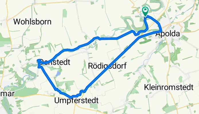
Apolda - Umpferstedt - Kromsdorf
A cycling route starting in Niederroßla, Free State of Thuringia, Germany.
Overview
About this route
Schöne, schnelle Runde für Zwischendurch. Hauptsächlich Asphalt, flach, aber windanfällig.
- -:--
- Duration
- 25.9 km
- Distance
- 147 m
- Ascent
- 150 m
- Descent
- ---
- Avg. speed
- ---
- Avg. speed
Route quality
Waytypes & surfaces along the route
Waytypes
Quiet road
8 km
(31 %)
Track
6.4 km
(25 %)
Surfaces
Paved
20.5 km
(79 %)
Asphalt
20.1 km
(78 %)
Concrete
0.2 km
(<1 %)
Continue with Bikemap
Use, edit, or download this cycling route
You would like to ride Apolda - Umpferstedt - Kromsdorf or customize it for your own trip? Here is what you can do with this Bikemap route:
Free features
- Save this route as favorite or in collections
- Copy & plan your own version of this route
- Sync your route with Garmin or Wahoo
Premium features
Free trial for 3 days, or one-time payment. More about Bikemap Premium.
- Navigate this route on iOS & Android
- Export a GPX / KML file of this route
- Create your custom printout (try it for free)
- Download this route for offline navigation
Discover more Premium features.
Get Bikemap PremiumFrom our community
Other popular routes starting in Niederroßla
 Weimar - Dürrenbacher Hütte
- Distance
- 30.2 km
- Ascent
- 246 m
- Descent
- 246 m
- Location
- Niederroßla, Free State of Thuringia, Germany
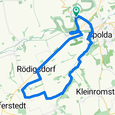 Rödigsdorf - Moorental - Apolda
- Distance
- 21 km
- Ascent
- 134 m
- Descent
- 134 m
- Location
- Niederroßla, Free State of Thuringia, Germany
 Bad Sulza - Auerstedt - Pfiffelbach
- Distance
- 39.6 km
- Ascent
- 212 m
- Descent
- 212 m
- Location
- Niederroßla, Free State of Thuringia, Germany
 Weimar/Schöndorf - Großobringen
- Distance
- 35.6 km
- Ascent
- 280 m
- Descent
- 280 m
- Location
- Niederroßla, Free State of Thuringia, Germany
 1. Mai AP - EF - ARN - Apolda
- Distance
- 140.5 km
- Ascent
- 306 m
- Descent
- 306 m
- Location
- Niederroßla, Free State of Thuringia, Germany
 Auf dem Radweg nach Ehringsdorf und zurück
- Distance
- 39.4 km
- Ascent
- 165 m
- Descent
- 166 m
- Location
- Niederroßla, Free State of Thuringia, Germany
 Zum Feininger Turm nach Mellingen
- Distance
- 48 km
- Ascent
- 151 m
- Descent
- 151 m
- Location
- Niederroßla, Free State of Thuringia, Germany
 Nach Oßmannstedt, dann Feldwege zurück
- Distance
- 13.3 km
- Ascent
- 155 m
- Descent
- 155 m
- Location
- Niederroßla, Free State of Thuringia, Germany
Open it in the app