

Knüll - Kellerwald - Knüll
A cycling route starting in Neukirchen, Hesse, Germany.
Overview
About this route
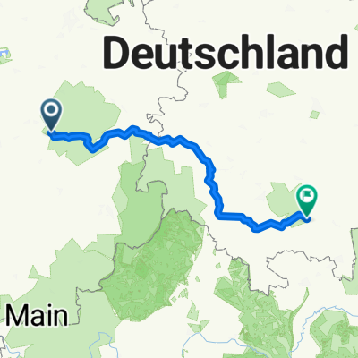
Seigertshausen - Leimsfeld - Allendorf - Schlierbach - Jesberg - Kellerwaldturm - Densberg - Sebbeterode - Rommershausen - Ziegenhain - Niedergrenzebach - Steinatal - Seigertshausen
- -:--
- Duration
- 74.3 km
- Distance
- 1,066 m
- Ascent
- 1,036 m
- Descent
- ---
- Avg. speed
- ---
- Avg. speed
Route quality
Waytypes & surfaces along the route
Waytypes
Track
49 km
(66 %)
Quiet road
12.5 km
(17 %)
Surfaces
Paved
24.2 km
(33 %)
Unpaved
38.2 km
(51 %)
Gravel
34.3 km
(46 %)
Asphalt
19.4 km
(26 %)
Continue with Bikemap
Use, edit, or download this cycling route
You would like to ride Knüll - Kellerwald - Knüll or customize it for your own trip? Here is what you can do with this Bikemap route:
Free features
- Save this route as favorite or in collections
- Copy & plan your own version of this route
- Sync your route with Garmin or Wahoo
Premium features
Free trial for 3 days, or one-time payment. More about Bikemap Premium.
- Navigate this route on iOS & Android
- Export a GPX / KML file of this route
- Create your custom printout (try it for free)
- Download this route for offline navigation
Discover more Premium features.
Get Bikemap PremiumFrom our community
Other popular routes starting in Neukirchen
 Knüll - Kellerwald - Knüll
- Distance
- 74.3 km
- Ascent
- 1,066 m
- Descent
- 1,036 m
- Location
- Neukirchen, Hesse, Germany
 Rund um den Knüll
- Distance
- 39.5 km
- Ascent
- 904 m
- Descent
- 904 m
- Location
- Neukirchen, Hesse, Germany
 D4 2013
- Distance
- 231.1 km
- Ascent
- 612 m
- Descent
- 663 m
- Location
- Neukirchen, Hesse, Germany
 Neukirchen-Hersfeld und zurück
- Distance
- 89.3 km
- Ascent
- 896 m
- Descent
- 858 m
- Location
- Neukirchen, Hesse, Germany
 Nausis Kreuzberg
- Distance
- 261.5 km
- Ascent
- 1,359 m
- Descent
- 1,359 m
- Location
- Neukirchen, Hesse, Germany
 Homberg, dann durch den Knüll; mit Eisenberg
- Distance
- 91 km
- Ascent
- 1,086 m
- Descent
- 1,035 m
- Location
- Neukirchen, Hesse, Germany
 34626 to: Papenburg
- Distance
- 547 km
- Ascent
- 370 m
- Descent
- 673 m
- Location
- Neukirchen, Hesse, Germany
 Neukirchen_Masserberg
- Distance
- 182.9 km
- Ascent
- 998 m
- Descent
- 473 m
- Location
- Neukirchen, Hesse, Germany
Open it in the app