

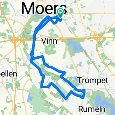
Schlägel-und-Eisen-Straße 8, Neukirchen-Vluyn nach Kamperdickstraße 17, Kamp-Lintfort
A cycling route starting in Moers, North Rhine-Westphalia, Germany.
Overview
About this route
- 35 min
- Duration
- 9.5 km
- Distance
- 26 m
- Ascent
- 27 m
- Descent
- 16.2 km/h
- Avg. speed
- 44 m
- Avg. speed
Route quality
Waytypes & surfaces along the route
Waytypes
Quiet road
6.3 km
(66 %)
Road
1.4 km
(15 %)
Surfaces
Paved
8.8 km
(93 %)
Asphalt
7.5 km
(79 %)
Paved (undefined)
0.8 km
(8 %)
Continue with Bikemap
Use, edit, or download this cycling route
You would like to ride Schlägel-und-Eisen-Straße 8, Neukirchen-Vluyn nach Kamperdickstraße 17, Kamp-Lintfort or customize it for your own trip? Here is what you can do with this Bikemap route:
Free features
- Save this route as favorite or in collections
- Copy & plan your own version of this route
- Sync your route with Garmin or Wahoo
Premium features
Free trial for 3 days, or one-time payment. More about Bikemap Premium.
- Navigate this route on iOS & Android
- Export a GPX / KML file of this route
- Create your custom printout (try it for free)
- Download this route for offline navigation
Discover more Premium features.
Get Bikemap PremiumFrom our community
Other popular routes starting in Moers
 Entspannende Route in
- Distance
- 17.6 km
- Ascent
- 16 m
- Descent
- 10 m
- Location
- Moers, North Rhine-Westphalia, Germany
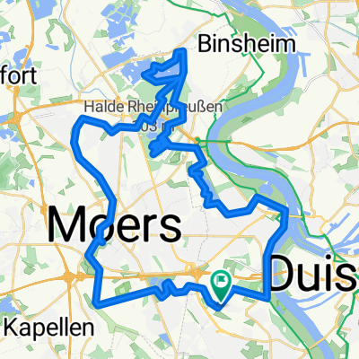 Moers: Die Halde und 4 Seen
- Distance
- 46.2 km
- Ascent
- 187 m
- Descent
- 181 m
- Location
- Moers, North Rhine-Westphalia, Germany
 4-Städte-Tour
- Distance
- 43.4 km
- Ascent
- 100 m
- Descent
- 104 m
- Location
- Moers, North Rhine-Westphalia, Germany
 Feierabend in Moers
- Distance
- 25.9 km
- Ascent
- 52 m
- Descent
- 55 m
- Location
- Moers, North Rhine-Westphalia, Germany
 Moers: Die Halde und 4 Seen CLONED FROM ROUTE 137557
- Distance
- 46.2 km
- Ascent
- 124 m
- Descent
- 123 m
- Location
- Moers, North Rhine-Westphalia, Germany
 Niederrheinischer Radwandertag Route 15
- Distance
- 43.5 km
- Ascent
- 39 m
- Descent
- 38 m
- Location
- Moers, North Rhine-Westphalia, Germany
 Niederrheinroute
- Distance
- 41.3 km
- Ascent
- 29 m
- Descent
- 29 m
- Location
- Moers, North Rhine-Westphalia, Germany
 MO_Vennikel-Rheinberg_Eversael-Runde.gpx
- Distance
- 47.3 km
- Ascent
- 18 m
- Descent
- 21 m
- Location
- Moers, North Rhine-Westphalia, Germany
Open it in the app