
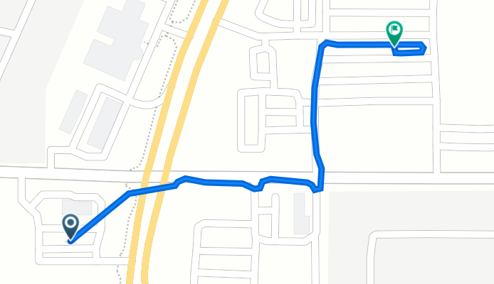
20430 N John Wayne Pkwy, Maricopa to 44460 W Edison Rd, Maricopa
A cycling route starting in Maricopa, Arizona, United States of America.
Overview
About this route
- 4 min
- Duration
- 0.6 km
- Distance
- 0 m
- Ascent
- 3 m
- Descent
- 7.5 km/h
- Avg. speed
- 359 m
- Avg. speed

Route quality
Waytypes & surfaces along the route
Waytypes
Access road
0.3 km
(56 %)
Pedestrian area
0.1 km
(26 %)
Surfaces
Paved
0.6 km
(100 %)
Asphalt
0.4 km
(77 %)
Concrete
0.1 km
(23 %)
Continue with Bikemap
Use, edit, or download this cycling route
You would like to ride 20430 N John Wayne Pkwy, Maricopa to 44460 W Edison Rd, Maricopa or customize it for your own trip? Here is what you can do with this Bikemap route:
Free features
- Save this route as favorite or in collections
- Copy & plan your own version of this route
- Sync your route with Garmin or Wahoo
Premium features
Free trial for 3 days, or one-time payment. More about Bikemap Premium.
- Navigate this route on iOS & Android
- Export a GPX / KML file of this route
- Create your custom printout (try it for free)
- Download this route for offline navigation
Discover more Premium features.
Get Bikemap PremiumFrom our community
Other popular routes starting in Maricopa
 39977 W Williams Way, Maricopa to 39977 W Williams Way, Maricopa
- Distance
- 17.1 km
- Ascent
- 34 m
- Descent
- 34 m
- Location
- Maricopa, Arizona, United States of America
 20430 N John Wayne Pkwy, Maricopa to 44460 W Edison Rd, Maricopa
- Distance
- 0.6 km
- Ascent
- 0 m
- Descent
- 3 m
- Location
- Maricopa, Arizona, United States of America
 36303 W Velazquez Dr, Maricopa to 36303 W Velazquez Dr, Maricopa
- Distance
- 10.9 km
- Ascent
- 7 m
- Descent
- 6 m
- Location
- Maricopa, Arizona, United States of America
 19800 N Toledo Ave, Maricopa to 36303 W Velazquez Dr, Maricopa
- Distance
- 21.6 km
- Ascent
- 16 m
- Descent
- 14 m
- Location
- Maricopa, Arizona, United States of America
 W Williams Way, Maricopa to W Williams Way, Maricopa
- Distance
- 17 km
- Ascent
- 16 m
- Descent
- 16 m
- Location
- Maricopa, Arizona, United States of America
 West Bedford Drive 40812, Maricopa to West Rio Bravo Drive 41241, Maricopa
- Distance
- 3.8 km
- Ascent
- 15 m
- Descent
- 15 m
- Location
- Maricopa, Arizona, United States of America
 Good Vibrations Lane 42293, Maricopa to North Geyser Drive 20132, Maricopa
- Distance
- 1.8 km
- Ascent
- 4 m
- Descent
- 4 m
- Location
- Maricopa, Arizona, United States of America
 36700–38754 W Farrell Rd, Maricopa to 36303 W Velazquez Dr, Maricopa
- Distance
- 17 km
- Ascent
- 36 m
- Descent
- 38 m
- Location
- Maricopa, Arizona, United States of America
Open it in the app