
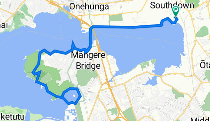
Hugo Johnston Drive 164-220, Auckland to Hugo Johnston Drive 213, Auckland
A cycling route starting in Mangere, Auckland, New Zealand.
Overview
About this route
- 1 h 29 min
- Duration
- 24.8 km
- Distance
- 107 m
- Ascent
- 145 m
- Descent
- 16.8 km/h
- Avg. speed
- 46 m
- Avg. speed

Route quality
Waytypes & surfaces along the route
Waytypes
Cycleway
13.6 km
(55 %)
Access road
4 km
(16 %)
Surfaces
Paved
18.8 km
(76 %)
Unpaved
5.8 km
(23 %)
Concrete
15.7 km
(63 %)
Gravel
5.7 km
(23 %)
Continue with Bikemap
Use, edit, or download this cycling route
You would like to ride Hugo Johnston Drive 164-220, Auckland to Hugo Johnston Drive 213, Auckland or customize it for your own trip? Here is what you can do with this Bikemap route:
Free features
- Save this route as favorite or in collections
- Copy & plan your own version of this route
- Sync your route with Garmin or Wahoo
Premium features
Free trial for 3 days, or one-time payment. More about Bikemap Premium.
- Navigate this route on iOS & Android
- Export a GPX / KML file of this route
- Create your custom printout (try it for free)
- Download this route for offline navigation
Discover more Premium features.
Get Bikemap PremiumFrom our community
Other popular routes starting in Mangere
 New Zealand 2013
- Distance
- 4,595.7 km
- Ascent
- 91,417 m
- Descent
- 91,416 m
- Location
- Mangere, Auckland, New Zealand
 New Zealand 2011 (part 1)
- Distance
- 4,599.1 km
- Ascent
- 5,029 m
- Descent
- 5,031 m
- Location
- Mangere, Auckland, New Zealand
 NZ 2015
- Distance
- 5,735.7 km
- Ascent
- 4,197 m
- Descent
- 4,188 m
- Location
- Mangere, Auckland, New Zealand
 New Zealand P6 Maranga Option
- Distance
- 1,038.3 km
- Ascent
- 2,668 m
- Descent
- 2,668 m
- Location
- Mangere, Auckland, New Zealand
 2012 Nieuw Zeeland
- Distance
- 3,658.5 km
- Ascent
- 5,799 m
- Descent
- 5,807 m
- Location
- Mangere, Auckland, New Zealand
 20km Mangere Bridge to Airport loop
- Distance
- 19.7 km
- Ascent
- 76 m
- Descent
- 79 m
- Location
- Mangere, Auckland, New Zealand
 第二天的行程:奧克蘭-基督城-福斯冰河小鎮
- Distance
- 1,208.4 km
- Ascent
- 3,890 m
- Descent
- 3,750 m
- Location
- Mangere, Auckland, New Zealand
 New Zealand 1989
- Distance
- 1,506 km
- Ascent
- 2,637 m
- Descent
- 2,637 m
- Location
- Mangere, Auckland, New Zealand
Open it in the app