

Nordstraße 103, Ilmenau nach Johann-Friedrich-Böttger-Straße 9A, Ilmenau
A cycling route starting in Frauenwald, Free State of Thuringia, Germany.
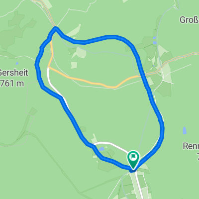
Overview
About this route
- 42 min
- Duration
- 15.8 km
- Distance
- 185 m
- Ascent
- 456 m
- Descent
- 22.4 km/h
- Avg. speed
- 816 m
- Avg. speed

Route quality
Waytypes & surfaces along the route
Waytypes
Track
12 km
(76 %)
Quiet road
2.5 km
(16 %)
Surfaces
Paved
3.5 km
(22 %)
Unpaved
12.2 km
(78 %)
Loose gravel
10.7 km
(68 %)
Asphalt
3.5 km
(22 %)
Continue with Bikemap
Use, edit, or download this cycling route
You would like to ride Nordstraße 103, Ilmenau nach Johann-Friedrich-Böttger-Straße 9A, Ilmenau or customize it for your own trip? Here is what you can do with this Bikemap route:
Free features
- Save this route as favorite or in collections
- Copy & plan your own version of this route
- Sync your route with Garmin or Wahoo
Premium features
Free trial for 3 days, or one-time payment. More about Bikemap Premium.
- Navigate this route on iOS & Android
- Export a GPX / KML file of this route
- Create your custom printout (try it for free)
- Download this route for offline navigation
Discover more Premium features.
Get Bikemap PremiumFrom our community
Other popular routes starting in Frauenwald
 Frauenwald - Neustadt - Schönbrunn - Frauenwald
- Distance
- 38.5 km
- Ascent
- 628 m
- Descent
- 626 m
- Location
- Frauenwald, Free State of Thuringia, Germany
 Frauenwald / Hörschel 2.Tag
- Distance
- 56 km
- Ascent
- 724 m
- Descent
- 1,298 m
- Location
- Frauenwald, Free State of Thuringia, Germany
 einrollrunde
- Distance
- 26 km
- Ascent
- 309 m
- Descent
- 267 m
- Location
- Frauenwald, Free State of Thuringia, Germany
 Talsperre Schönbrunn (lang)
- Distance
- 16.3 km
- Ascent
- 414 m
- Descent
- 414 m
- Location
- Frauenwald, Free State of Thuringia, Germany
 Frauenwald-Finsterberg-Schneekopf-Dörrberg-Beerberg
- Distance
- 58.9 km
- Ascent
- 927 m
- Descent
- 927 m
- Location
- Frauenwald, Free State of Thuringia, Germany
 Von Frauenwald zu den schönsten Gipfeln
- Distance
- 51.7 km
- Ascent
- 865 m
- Descent
- 867 m
- Location
- Frauenwald, Free State of Thuringia, Germany
 20160119_111958.gpx
- Distance
- 5.7 km
- Ascent
- 92 m
- Descent
- 95 m
- Location
- Frauenwald, Free State of Thuringia, Germany
 Rund um die Talsperre Schönbrunn
- Distance
- 16.3 km
- Ascent
- 474 m
- Descent
- 463 m
- Location
- Frauenwald, Free State of Thuringia, Germany
Open it in the app