

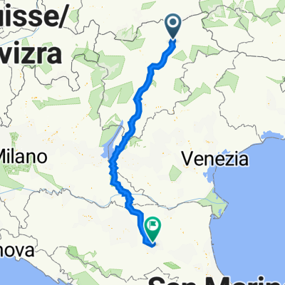
EV7-BRIXEN-GARDA-BLOGNA
A cycling route starting in Natz-Schabs, Trentino-Alto Adige, Italy.
Overview
About this route
- -:--
- Duration
- 368.5 km
- Distance
- 1,817 m
- Ascent
- 2,540 m
- Descent
- ---
- Avg. speed
- 771 m
- Avg. speed

Route quality
Waytypes & surfaces along the route
Waytypes
Cycleway
207 km
(56 %)
Quiet road
68.8 km
(19 %)
Surfaces
Paved
298.5 km
(81 %)
Unpaved
11.9 km
(3 %)
Asphalt
286.7 km
(78 %)
Paved (undefined)
7.9 km
(2 %)
Continue with Bikemap
Use, edit, or download this cycling route
You would like to ride EV7-BRIXEN-GARDA-BLOGNA or customize it for your own trip? Here is what you can do with this Bikemap route:
Free features
- Save this route as favorite or in collections
- Copy & plan your own version of this route
- Sync your route with Garmin or Wahoo
Premium features
Free trial for 3 days, or one-time payment. More about Bikemap Premium.
- Navigate this route on iOS & Android
- Export a GPX / KML file of this route
- Create your custom printout (try it for free)
- Download this route for offline navigation
Discover more Premium features.
Get Bikemap PremiumFrom our community
Other popular routes starting in Natz-Schabs
 Brenner-Franzenfeste
- Distance
- 60.8 km
- Ascent
- 1,274 m
- Descent
- 817 m
- Location
- Natz-Schabs, Trentino-Alto Adige, Italy
 Toblach - Bruneck - Neustift
- Distance
- 86 km
- Ascent
- 1,429 m
- Descent
- 1,646 m
- Location
- Natz-Schabs, Trentino-Alto Adige, Italy
 Drauradweg
- Distance
- 261.9 km
- Ascent
- 877 m
- Descent
- 1,157 m
- Location
- Natz-Schabs, Trentino-Alto Adige, Italy
 Velotour Alpen Ost 2025 11
- Distance
- 67.8 km
- Ascent
- 1,743 m
- Descent
- 1,523 m
- Location
- Natz-Schabs, Trentino-Alto Adige, Italy
 Teil 6: Pustertalradweg: Varna - Toblach
- Distance
- 60.7 km
- Ascent
- 718 m
- Descent
- 198 m
- Location
- Natz-Schabs, Trentino-Alto Adige, Italy
 Eta4 Natz/Schabs-Bozen
- Distance
- 50.6 km
- Ascent
- 74 m
- Descent
- 579 m
- Location
- Natz-Schabs, Trentino-Alto Adige, Italy
 EV7-BRIXEN-GARDA-BLOGNA
- Distance
- 368.5 km
- Ascent
- 1,817 m
- Descent
- 2,540 m
- Location
- Natz-Schabs, Trentino-Alto Adige, Italy
 KESCHTNWEG - SÜDTIROL
- Distance
- 121.2 km
- Ascent
- 3,039 m
- Descent
- 2,827 m
- Location
- Natz-Schabs, Trentino-Alto Adige, Italy
Open it in the app