

KESCHTNWEG - SÜDTIROL
A cycling route starting in Natz-Schabs, Trentino-Alto Adige, Italy.
Overview
About this route
Eine Wanderroute im Zeichen der Kastanie quer durch Südtirol. Diese Vision ist vor einigen Jahren im Eisacktal entstanden und hat sich nun von Vahrn, dem nördlichsten Ort bis in den Vinschgau ausgeweitet.
- -:--
- Duration
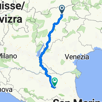
- 121.2 km
- Distance
- 3,039 m
- Ascent
- 2,827 m
- Descent
- ---
- Avg. speed
- ---
- Avg. speed

Continue with Bikemap
Use, edit, or download this cycling route
You would like to ride KESCHTNWEG - SÜDTIROL or customize it for your own trip? Here is what you can do with this Bikemap route:
Free features
- Save this route as favorite or in collections
- Copy & plan your own version of this route
- Sync your route with Garmin or Wahoo
Premium features
Free trial for 3 days, or one-time payment. More about Bikemap Premium.
- Navigate this route on iOS & Android
- Export a GPX / KML file of this route
- Create your custom printout (try it for free)
- Download this route for offline navigation
Discover more Premium features.
Get Bikemap PremiumFrom our community
Other popular routes starting in Natz-Schabs
 von Brixen durch die Dolomiten nach Cres
- Distance
- 424.7 km
- Ascent
- 1,947 m
- Descent
- 2,651 m
- Location
- Natz-Schabs, Trentino-Alto Adige, Italy
 EV7-BRIXEN-GARDA-BLOGNA
- Distance
- 368.5 km
- Ascent
- 1,817 m
- Descent
- 2,540 m
- Location
- Natz-Schabs, Trentino-Alto Adige, Italy
 Velotour Alpen Ost 2025 11
- Distance
- 67.8 km
- Ascent
- 1,743 m
- Descent
- 1,523 m
- Location
- Natz-Schabs, Trentino-Alto Adige, Italy
 Teil 6: Pustertalradweg: Varna - Toblach
- Distance
- 60.7 km
- Ascent
- 718 m
- Descent
- 198 m
- Location
- Natz-Schabs, Trentino-Alto Adige, Italy
 Aicha - Ronerhütte
- Distance
- 19.4 km
- Ascent
- 1,282 m
- Descent
- 172 m
- Location
- Natz-Schabs, Trentino-Alto Adige, Italy
 Eta4 Natz/Schabs-Bozen
- Distance
- 50.6 km
- Ascent
- 74 m
- Descent
- 579 m
- Location
- Natz-Schabs, Trentino-Alto Adige, Italy
 Tag 1 (Schabs-Prissian) 4:47
- Distance
- 68 km
- Ascent
- 505 m
- Descent
- 667 m
- Location
- Natz-Schabs, Trentino-Alto Adige, Italy
 KESCHTNWEG - SÜDTIROL
- Distance
- 121.2 km
- Ascent
- 3,039 m
- Descent
- 2,827 m
- Location
- Natz-Schabs, Trentino-Alto Adige, Italy
Open it in the app