

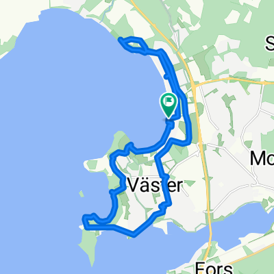
Bispmotalagatan 4A to Vätterpromenaden 22
A cycling route starting in Motala, Östergötland County, Sweden.
Overview
About this route
- 23 h 32 min
- Duration
- 363.6 km
- Distance
- 2,863 m
- Ascent
- 2,871 m
- Descent
- 15.4 km/h
- Avg. speed
- 254 m
- Max. altitude

Route quality
Waytypes & surfaces along the route
Waytypes
Road
98.2 km
(27 %)
Quiet road
90.9 km
(25 %)
Surfaces
Paved
272.7 km
(75 %)
Unpaved
50.9 km
(14 %)
Asphalt
243.6 km
(67 %)
Paved (undefined)
29.1 km
(8 %)
Continue with Bikemap
Use, edit, or download this cycling route
You would like to ride Bispmotalagatan 4A to Vätterpromenaden 22 or customize it for your own trip? Here is what you can do with this Bikemap route:
Free features
- Save this route as favorite or in collections
- Copy & plan your own version of this route
- Split it into stages to create a multi-day tour
- Sync your route with Garmin or Wahoo
Premium features
Free trial for 3 days, or one-time payment. More about Bikemap Premium.
- Navigate this route on iOS & Android
- Export a GPX / KML file of this route
- Create your custom printout (try it for free)
- Download this route for offline navigation
Discover more Premium features.
Get Bikemap PremiumFrom our community
Other popular routes starting in Motala
 Motala 17-03-18
- Distance
- 13.4 km
- Ascent
- 58 m
- Descent
- 58 m
- Location
- Motala, Östergötland County, Sweden
 bike tour through Medevi
- Distance
- 22.9 km
- Ascent
- 199 m
- Descent
- 169 m
- Location
- Motala, Östergötland County, Sweden
 Vätternrundan 2009
- Distance
- 299.5 km
- Ascent
- 568 m
- Descent
- 569 m
- Location
- Motala, Östergötland County, Sweden
 VR_2018
- Distance
- 296.6 km
- Ascent
- 457 m
- Descent
- 458 m
- Location
- Motala, Östergötland County, Sweden
 2025-Schweden: Von Motala nach Oskarshamn
- Distance
- 341 km
- Ascent
- 2,609 m
- Descent
- 2,697 m
- Location
- Motala, Östergötland County, Sweden
 S_Vätternrundan
- Distance
- 299.6 km
- Ascent
- 568 m
- Descent
- 569 m
- Location
- Motala, Östergötland County, Sweden
 Vätternrundan
- Distance
- 293.9 km
- Ascent
- 439 m
- Descent
- 440 m
- Location
- Motala, Östergötland County, Sweden
 Vätternrundan 2009
- Distance
- 297.4 km
- Ascent
- 1,022 m
- Descent
- 1,002 m
- Location
- Motala, Östergötland County, Sweden
Open it in the app