

Sykkylven 1
A cycling route starting in Sykkylven, Møre og Romsdal fylke, Norway.
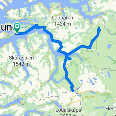
Overview
About this route
- -:--
- Duration
- 46.7 km
- Distance
- 613 m
- Ascent
- 614 m
- Descent
- ---
- Avg. speed
- 390 m
- Avg. speed
Route quality
Waytypes & surfaces along the route
Waytypes
Busy road
27 km
(58 %)
Road
13.5 km
(29 %)
Surfaces
Paved
17 km
(36 %)
Asphalt
17 km
(36 %)
Undefined
29.7 km
(64 %)
Continue with Bikemap
Use, edit, or download this cycling route
You would like to ride Sykkylven 1 or customize it for your own trip? Here is what you can do with this Bikemap route:
Free features
- Save this route as favorite or in collections
- Copy & plan your own version of this route
- Sync your route with Garmin or Wahoo
Premium features
Free trial for 3 days, or one-time payment. More about Bikemap Premium.
- Navigate this route on iOS & Android
- Export a GPX / KML file of this route
- Create your custom printout (try it for free)
- Download this route for offline navigation
Discover more Premium features.
Get Bikemap PremiumFrom our community
Other popular routes starting in Sykkylven
 basen
basen- Distance
- 4.6 km
- Ascent
- 10 m
- Descent
- 7 m
- Location
- Sykkylven, Møre og Romsdal fylke, Norway
 August Challenge CCT
- Distance
- 182.8 km
- Ascent
- 0 m
- Descent
- 0 m
- Location
- Sykkylven, Møre og Romsdal fylke, Norway
 Kongerute Monsen
- Distance
- 323.9 km
- Ascent
- 0 m
- Descent
- 0 m
- Location
- Sykkylven, Møre og Romsdal fylke, Norway
 Eikenos
- Distance
- 1.6 km
- Ascent
- 180 m
- Descent
- 31 m
- Location
- Sykkylven, Møre og Romsdal fylke, Norway
 Elvemyrvegen 2 do Blindheimsbreivika 160
- Distance
- 6.3 km
- Ascent
- 6 m
- Descent
- 0 m
- Location
- Sykkylven, Møre og Romsdal fylke, Norway
 emblem - magerholm - emblem sanden
- Distance
- 3.6 km
- Ascent
- 18 m
- Descent
- 51 m
- Location
- Sykkylven, Møre og Romsdal fylke, Norway
 Lysløype - Emblemsfjell (Gamlevegen Østrem)
- Distance
- 7.7 km
- Ascent
- 242 m
- Descent
- 242 m
- Location
- Sykkylven, Møre og Romsdal fylke, Norway
 Sykkylven - Aalesund route, without highway
- Distance
- 29.9 km
- Ascent
- 360 m
- Descent
- 397 m
- Location
- Sykkylven, Møre og Romsdal fylke, Norway
Open it in the app