

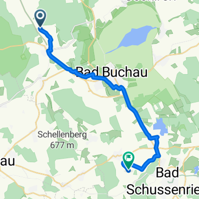
L282, Ertingen nach Plettenbergstraße 7, Geislingen
A cycling route starting in Kanzach, Baden-Württemberg, Germany.
Overview
About this route
- 19 h 14 min
- Duration
- 170.1 km
- Distance
- 1,292 m
- Ascent
- 1,359 m
- Descent
- 8.8 km/h
- Avg. speed
- 862 m
- Avg. speed

Route quality
Waytypes & surfaces along the route
Waytypes
Busy road
87.2 km
(51 %)
Track
24.2 km
(14 %)
Surfaces
Paved
116.2 km
(68 %)
Unpaved
6.1 km
(4 %)
Asphalt
113.6 km
(67 %)
Gravel
3.1 km
(2 %)
Continue with Bikemap
Use, edit, or download this cycling route
You would like to ride L282, Ertingen nach Plettenbergstraße 7, Geislingen or customize it for your own trip? Here is what you can do with this Bikemap route:
Free features
- Save this route as favorite or in collections
- Copy & plan your own version of this route
- Sync your route with Garmin or Wahoo
Premium features
Free trial for 3 days, or one-time payment. More about Bikemap Premium.
- Navigate this route on iOS & Android
- Export a GPX / KML file of this route
- Create your custom printout (try it for free)
- Download this route for offline navigation
Discover more Premium features.
Get Bikemap PremiumFrom our community
Other popular routes starting in Kanzach
 Rund um den Federsee
- Distance
- 24 km
- Ascent
- 110 m
- Descent
- 109 m
- Location
- Kanzach, Baden-Württemberg, Germany
 Rund um den Federsee
- Distance
- 24 km
- Ascent
- 105 m
- Descent
- 104 m
- Location
- Kanzach, Baden-Württemberg, Germany
 Über HKT- Riedlingen
- Distance
- 39.2 km
- Ascent
- 170 m
- Descent
- 179 m
- Location
- Kanzach, Baden-Württemberg, Germany
 Rund um den Federsee
- Distance
- 24 km
- Ascent
- 132 m
- Descent
- 130 m
- Location
- Kanzach, Baden-Württemberg, Germany
 Marbacher Straße 1, Kanzach nach Schillerstraße 8, Ertingen
- Distance
- 7.8 km
- Ascent
- 0 m
- Descent
- 5 m
- Location
- Kanzach, Baden-Württemberg, Germany
 L282, Ertingen nach Plettenbergstraße 7, Geislingen
- Distance
- 170.1 km
- Ascent
- 1,292 m
- Descent
- 1,359 m
- Location
- Kanzach, Baden-Württemberg, Germany
 Seelenwald 24, Kanzach nach Riedlinger Straße 12, Kanzach
- Distance
- 21.5 km
- Ascent
- 26 m
- Descent
- 20 m
- Location
- Kanzach, Baden-Württemberg, Germany
 Seelenwald, Kanzach nach K 7557, Bad Schussenried
- Distance
- 16.2 km
- Ascent
- 64 m
- Descent
- 30 m
- Location
- Kanzach, Baden-Württemberg, Germany
Open it in the app