

To Eagle Rock
A cycling route starting in View Park-Windsor Hills, California, United States of America.
Overview
About this route
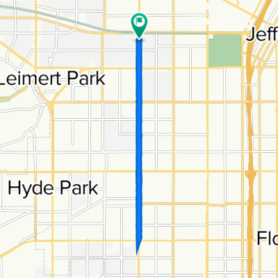
i went from the U.S.C area to Eagle Rock. I took Figueroa up north through Down town then got on to Broadway crossed the bridge and connect back on to Fuigeroa at some point. on figueroa i went to Yorkblvd. I went back the same general way.
- -:--
- Duration
- 21.4 km
- Distance
- 274 m
- Ascent
- 135 m
- Descent
- ---
- Avg. speed
- ---
- Avg. speed
Continue with Bikemap
Use, edit, or download this cycling route
You would like to ride To Eagle Rock or customize it for your own trip? Here is what you can do with this Bikemap route:
Free features
- Save this route as favorite or in collections
- Copy & plan your own version of this route
- Sync your route with Garmin or Wahoo
Premium features
Free trial for 3 days, or one-time payment. More about Bikemap Premium.
- Navigate this route on iOS & Android
- Export a GPX / KML file of this route
- Create your custom printout (try it for free)
- Download this route for offline navigation
Discover more Premium features.
Get Bikemap PremiumFrom our community
Other popular routes starting in View Park-Windsor Hills
 CicLAvia Route (Florence to Exposition via Western) 👨👩👧👦
- Distance
- 9.4 km
- Ascent
- 7 m
- Descent
- 7 m
- Location
- View Park-Windsor Hills, California, United States of America
 12/2/16 Bike Route #1
- Distance
- 63.8 km
- Ascent
- 462 m
- Descent
- 461 m
- Location
- View Park-Windsor Hills, California, United States of America
 Steady ride in Santa Monica
- Distance
- 20.9 km
- Ascent
- 190 m
- Descent
- 186 m
- Location
- View Park-Windsor Hills, California, United States of America
 1247 W 37th Dr, Los Angeles to 928 S Western Ave, Los Angeles
- Distance
- 7.7 km
- Ascent
- 38 m
- Descent
- 33 m
- Location
- View Park-Windsor Hills, California, United States of America
 To Eagle Rock
- Distance
- 21.4 km
- Ascent
- 274 m
- Descent
- 135 m
- Location
- View Park-Windsor Hills, California, United States of America
 1252 W 37th Dr, Los Angeles to Karis Ln, Los Angeles
- Distance
- 10.7 km
- Ascent
- 125 m
- Descent
- 37 m
- Location
- View Park-Windsor Hills, California, United States of America
 1257 W 37th Dr, Los Angeles to 3629 S Vermont Ave, Los Angeles
- Distance
- 44.2 km
- Ascent
- 149 m
- Descent
- 153 m
- Location
- View Park-Windsor Hills, California, United States of America
 Lengthy ride from Los Angeles to Manhattan Beach
- Distance
- 33.5 km
- Ascent
- 123 m
- Descent
- 146 m
- Location
- View Park-Windsor Hills, California, United States of America
Open it in the app