Premium Badge Download on the App Store Get it on Google Play Turn-by-turn Navigation Offline Maps Bike Type Optimized Routing Premium Maps Custom Bike Computer Export Routes Route Previews Fall Detection Premium Support

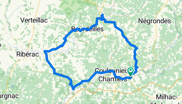
Cycling Route in Trélissac, Aquitaine-Limousin-Poitou-Charentes, France

Ride Day 42—26 Oct 2005—24750 Boulazac (Périgueux) -- Circle

1
Open this route in the Bikemap app

Open this route in the Bikemap app

Open this route in Bikemap Web

Open this route in Bikemap Web

105 km
Distance
690 m
Ascent
690 m
Descent
-:-- h
Duration
-- km/h
Avg. Speed
--- m
Max. Elevation

About This Route

@font-face { font-family: "Times New Roman"; }@font-face { font-family: "Arial"; }@font-face { font-family: "ArialMT"; }p.MsoNormal, li.MsoNormal, div.MsoNormal { margin: 0in 0in 0.0001pt; font-size: 12pt; font-family: "Times New Roman"; }table.MsoNormalTable { font-size: 10pt; font-family: "Times New Roman"; }div.Section1 { page: Section1; } <span style="font-size: 12pt; font-family: Arial;">With perfect weather and outstanding roads, this was simply wonderful riding.<span> </span>The only exception was the last segment coming back on D3 and D710 toward and through Périgueux, which was a reasonably adrenaline-pumping experience from all the traffic.<span> </span>Fortunately, a few miles before centre-ville, we found a bike path along the river that gave some respite, but it ended just before centre-ville itself.</span>

<span style="font-size: 12pt; font-family: Arial;">Our ride started off with an unexpected tour of some very nice homes in the neighborhoods of Trélissac that covered the hill overlooking the Isle River valley.<span> </span>Périgueux is within this valley.<span> </span>The reason this was unexpected was because we were lost.<span> </span>We did eventually negotiate the maze of neighborhood streets and end up exactly where my wife had intended that we would go.</span>

<span style="font-size: 12pt; font-family: Arial;">Throughout the ride today, the fall colors and textures of the fields was truly easy on the eyes. </span>

<span style="font-size: 12pt; font-family: Arial;">We stopped for lunch in Brantôme at a very picturesque spot by the river that runs through the town.<span> </span>This is just an outstanding looking town, especially with the water and fall colors.</span>

<span style="font-size: 12pt; font-family: Arial;">As we rode along the north side of the Dronne River on D78, D106E2 and D106, the rock formations were really something, with a few looking like faces.</span>

<span style="font-size: 12pt; font-family: Arial;">Overall, simply outstanding riding.<span> </span>It’s an area worth returning to, which we have in fact done a number of times since 2005.</span>

Background:

<br /><br />My wife and I have been doing self-supported tours in Western Europe (a majority in France) since 1993.  This series of rides covers our 2005 2 month route through parts of France.  Our beginning and ending point is near Chadurie (south of Angoulême) where our friends have a farm with Gites and Chambres d'Hotes.<br /><br /><br />We rode our Dawes touring bicycles purchased in 1993 heavily loaded with 700Cx32 tires.  All of our riding was on paved roads, mostly with very little traffic.<br /><br /><br />If any questions, feel free to email me at jeffkadet@netdiving.com<br /><br /><br />Jeff

This cycling route is ideal for: Road bike

You will cycle on the following surfaces: Paved

Customize this cycling route with the Bikemap route planner.

Make it yours!

Did you know? You can use this route as a template in our cycling route planner if you don't wish to start from scratch. Customize it based on your needs to plan your perfect cycling tour.

Open it in the app