

18.11.2011
A cycling route starting in Gelnica, Košický kraj, Slovak Republic.
Overview
About this route
- -:--
- Duration
- 27.5 km
- Distance
- 646 m
- Ascent
- 646 m
- Descent
- ---
- Avg. speed
- ---
- Avg. speed

Route highlights
Points of interest along the route
Point of interest after 7.8 km
Tatarkov kríž
Point of interest after 8.5 km
Opustiť zelenú TZ a pokračovať rovno- smer Gáborka
Point of interest after 10 km
Napojiť sa na modrú TZ a pokračovať vpravo dole- po modrej smer Cechy, Thurzov
Point of interest after 10.8 km
Pokračovať rovno - po modrej
Point of interest after 11.2 km
Niekde tu opustiť modrú a pokračovať rovno
Point of interest after 12 km
Napojenie na poľnú cestu
Point of interest after 12.4 km
Pod prvým domom zabočiť vpravo, kúsok nastúpať
Point of interest after 12.6 km
Neomietnutá budova- zhora sa pripája modrá
Point of interest after 12.7 km
Tesne za rozdelením ciest zabočiť na chodník vpravo
Point of interest after 13 km
Niekde tu sa vľavo odpája chodník- začiatok singla, ktorý končí nad jazerom
Point of interest after 16.8 km
Koniec videa- parkovisko pri Rune
Continue with Bikemap
Use, edit, or download this cycling route
You would like to ride 18.11.2011 or customize it for your own trip? Here is what you can do with this Bikemap route:
Free features
- Save this route as favorite or in collections
- Copy & plan your own version of this route
- Sync your route with Garmin or Wahoo
Premium features
Free trial for 3 days, or one-time payment. More about Bikemap Premium.
- Navigate this route on iOS & Android
- Export a GPX / KML file of this route
- Create your custom printout (try it for free)
- Download this route for offline navigation
Discover more Premium features.
Get Bikemap PremiumFrom our community
Other popular routes starting in Gelnica
 GL-Margecany- Rolova Huta - v.n. Ružín- Bradan
- Distance
- 27 km
- Ascent
- 1,018 m
- Descent
- 1,030 m
- Location
- Gelnica, Košický kraj, Slovak Republic
 Gelnica-Cechy-Thurzov-Chata Olympia-Helcmanovce
- Distance
- 14.6 km
- Ascent
- 522 m
- Descent
- 731 m
- Location
- Gelnica, Košický kraj, Slovak Republic
 Singláč nad Ružínom - začiatok...
- Distance
- 3 km
- Ascent
- 87 m
- Descent
- 259 m
- Location
- Gelnica, Košický kraj, Slovak Republic
 jaklovce_kurtovaskala_plejsy_thurzov_jaklovce
- Distance
- 27.6 km
- Ascent
- 676 m
- Descent
- 676 m
- Location
- Gelnica, Košický kraj, Slovak Republic
 Jaklofsky bicigeľ 2014
- Distance
- 25.3 km
- Ascent
- 891 m
- Descent
- 891 m
- Location
- Gelnica, Košický kraj, Slovak Republic
 Helcmanovce-Tatarkov kríž-Slovinky-Poráč-Závadka-Nálepkovo-Helcmanovce
- Distance
- 61.2 km
- Ascent
- 1,066 m
- Descent
- 1,066 m
- Location
- Gelnica, Košický kraj, Slovak Republic
 GL-ch.Erika- Kojš.Hoľa - Zl.Idka- Bukovec v.n.
- Distance
- 39 km
- Ascent
- 1,069 m
- Descent
- 1,073 m
- Location
- Gelnica, Košický kraj, Slovak Republic
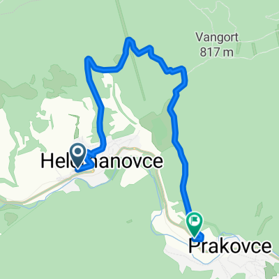 Helcmanovce-Prakovce (naokolo bližšie :-))
- Distance
- 8.2 km
- Ascent
- 341 m
- Descent
- 337 m
- Location
- Gelnica, Košický kraj, Slovak Republic
Open it in the app