

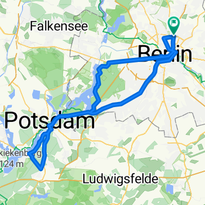
Theodor-Heuss-Weg 11, Berlin nach Hardenbergstraße 40A, Berlin
A cycling route starting in Gesundbrunnen, Land Berlin, Germany.
Overview
About this route
- 22 min
- Duration
- 6.4 km
- Distance
- 23 m
- Ascent
- 31 m
- Descent
- 17.3 km/h
- Avg. speed
- 46 m
- Avg. speed
Continue with Bikemap
Use, edit, or download this cycling route
You would like to ride Theodor-Heuss-Weg 11, Berlin nach Hardenbergstraße 40A, Berlin or customize it for your own trip? Here is what you can do with this Bikemap route:
Free features
- Save this route as favorite or in collections
- Copy & plan your own version of this route
- Sync your route with Garmin or Wahoo
Premium features
Free trial for 3 days, or one-time payment. More about Bikemap Premium.
- Navigate this route on iOS & Android
- Export a GPX / KML file of this route
- Create your custom printout (try it for free)
- Download this route for offline navigation
Discover more Premium features.
Get Bikemap PremiumFrom our community
Other popular routes starting in Gesundbrunnen
 Feierabendrunde für den Norden
- Distance
- 67.1 km
- Ascent
- 61 m
- Descent
- 56 m
- Location
- Gesundbrunnen, Land Berlin, Germany
![[45km] Wedding-Schönerlinde-Basdorf-Mühlenbeck-Wedding](https://media.bikemap.net/routes/2272514/staticmaps/in_2477869c-b609-427b-9e20-7cb285ac7bb1_400x400_bikemap-2021-3D-static.png) [45km] Wedding-Schönerlinde-Basdorf-Mühlenbeck-Wedding
[45km] Wedding-Schönerlinde-Basdorf-Mühlenbeck-Wedding- Distance
- 45.7 km
- Ascent
- 85 m
- Descent
- 85 m
- Location
- Gesundbrunnen, Land Berlin, Germany
 Prenzlauer Berg, Mühlenbeck, Blankenfelde
- Distance
- 33.8 km
- Ascent
- 44 m
- Descent
- 46 m
- Location
- Gesundbrunnen, Land Berlin, Germany
 Putbusser Straße, Berlin nach Putbusser Straße, Berlin
- Distance
- 31.1 km
- Ascent
- 541 m
- Descent
- 543 m
- Location
- Gesundbrunnen, Land Berlin, Germany
 Die Eberswalde Extension 2
- Distance
- 119.3 km
- Ascent
- 342 m
- Descent
- 342 m
- Location
- Gesundbrunnen, Land Berlin, Germany
 Training Nord 60 Lehnitz
- Distance
- 59.3 km
- Ascent
- 166 m
- Descent
- 162 m
- Location
- Gesundbrunnen, Land Berlin, Germany
 12 Strausberg Märkische Schweiz
- Distance
- 55.5 km
- Ascent
- 83 m
- Descent
- 83 m
- Location
- Gesundbrunnen, Land Berlin, Germany
 Raus aus Berlin, anschlagen und zurück
- Distance
- 96.3 km
- Ascent
- 393 m
- Descent
- 403 m
- Location
- Gesundbrunnen, Land Berlin, Germany
Open it in the app