
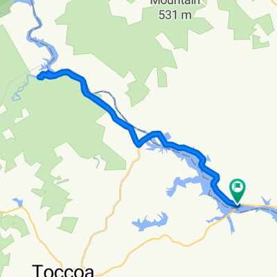
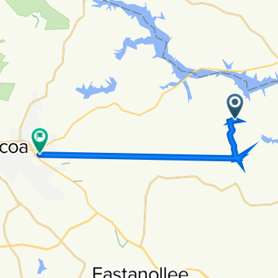
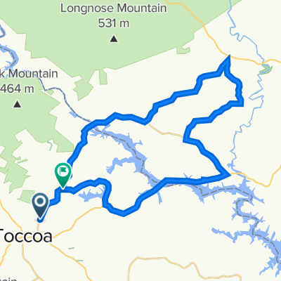
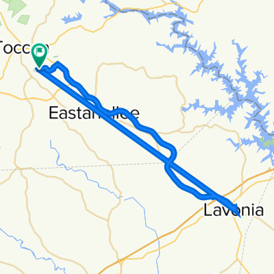
Currahee
A cycling route starting in Toccoa, Georgia, United States of America.
Overview
About this route
Possible loop around Currahee Mountain and former site of Camp Toccoa. Pavement and Dirt Road
- -:--
- Duration
- 24.3 km
- Distance
- 341 m
- Ascent
- 341 m
- Descent
- ---
- Avg. speed
- ---
- Avg. speed
Route highlights
Points of interest along the route
Point of interest after 3 km
Boy Scout Trail Head in Church Parking Lot
Point of interest after 3.1 km
Top of Currahee
Point of interest after 4.3 km
Camp Toccoa / Currahee Museum
Continue with Bikemap
Use, edit, or download this cycling route
You would like to ride Currahee or customize it for your own trip? Here is what you can do with this Bikemap route:
Free features
- Save this route as favorite or in collections
- Copy & plan your own version of this route
- Sync your route with Garmin or Wahoo
Premium features
Free trial for 3 days, or one-time payment. More about Bikemap Premium.
- Navigate this route on iOS & Android
- Export a GPX / KML file of this route
- Create your custom printout (try it for free)
- Download this route for offline navigation
Discover more Premium features.
Get Bikemap PremiumFrom our community
Other popular routes starting in Toccoa
 First day of August challenge
- Distance
- 24.2 km
- Ascent
- 288 m
- Descent
- 289 m
- Location
- Toccoa, Georgia, United States of America
 Sunday lunch ride
- Distance
- 33 km
- Ascent
- 394 m
- Descent
- 394 m
- Location
- Toccoa, Georgia, United States of America
 Easy ride in
- Distance
- 12.6 km
- Ascent
- 23 m
- Descent
- 20 m
- Location
- Toccoa, Georgia, United States of America
 The mid length ride
- Distance
- 47.3 km
- Ascent
- 499 m
- Descent
- 530 m
- Location
- Toccoa, Georgia, United States of America
 Nice Saturday ride with my baby 🤪
- Distance
- 51.1 km
- Ascent
- 322 m
- Descent
- 321 m
- Location
- Toccoa, Georgia, United States of America
 Oak Valley Road 5847, Toccoa to Flourney Drive 483, Toccoa
- Distance
- 12.5 km
- Ascent
- 220 m
- Descent
- 233 m
- Location
- Toccoa, Georgia, United States of America
 Mid day leg stretch 👍👍
- Distance
- 26.7 km
- Ascent
- 298 m
- Descent
- 295 m
- Location
- Toccoa, Georgia, United States of America
 Currahee
- Distance
- 24.3 km
- Ascent
- 341 m
- Descent
- 341 m
- Location
- Toccoa, Georgia, United States of America
Open it in the app