

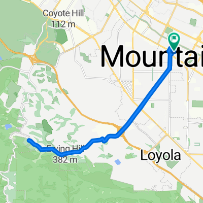
333 Escuela Ave, Mountain View to 3145 Porter Dr, Palo Alto
A cycling route starting in Mountain View, California, United States of America.
Overview
About this route
- 24 min
- Duration
- 7.6 km
- Distance
- 32 m
- Ascent
- 21 m
- Descent
- 19.3 km/h
- Avg. speed
- 42 m
- Avg. speed

Route quality
Waytypes & surfaces along the route
Waytypes
Busy road
3.5 km
(45 %)
Road
2 km
(27 %)
Surfaces
Paved
5.5 km
(73 %)
Asphalt
5.3 km
(70 %)
Wood
0.2 km
(3 %)
Undefined
2.1 km
(27 %)
Continue with Bikemap
Use, edit, or download this cycling route
You would like to ride 333 Escuela Ave, Mountain View to 3145 Porter Dr, Palo Alto or customize it for your own trip? Here is what you can do with this Bikemap route:
Free features
- Save this route as favorite or in collections
- Copy & plan your own version of this route
- Sync your route with Garmin or Wahoo
Premium features
Free trial for 3 days, or one-time payment. More about Bikemap Premium.
- Navigate this route on iOS & Android
- Export a GPX / KML file of this route
- Create your custom printout (try it for free)
- Download this route for offline navigation
Discover more Premium features.
Get Bikemap PremiumFrom our community
Other popular routes starting in Mountain View
 2940 N Shoreline Blvd, Mountain View to 1109 N Fair Oaks Ave, Sunnyvale
- Distance
- 41.6 km
- Ascent
- 0 m
- Descent
- 3 m
- Location
- Mountain View, California, United States of America
 Flat bay ride in Mountain View
- Distance
- 18.7 km
- Ascent
- 116 m
- Descent
- 113 m
- Location
- Mountain View, California, United States of America
 Tied House - Los Altos Hill Loop (Long)
- Distance
- 45.1 km
- Ascent
- 420 m
- Descent
- 418 m
- Location
- Mountain View, California, United States of America
 Peter's Hilly MountainView Ride
- Distance
- 38 km
- Ascent
- 460 m
- Descent
- 458 m
- Location
- Mountain View, California, United States of America
 Route in Mountain View
- Distance
- 14.7 km
- Ascent
- 171 m
- Descent
- 172 m
- Location
- Mountain View, California, United States of America
 Route1
- Distance
- 51.6 km
- Ascent
- 699 m
- Descent
- 710 m
- Location
- Mountain View, California, United States of America
 Moody quick
- Distance
- 19.1 km
- Ascent
- 233 m
- Descent
- 234 m
- Location
- Mountain View, California, United States of America
 601–695 Leong Dr, Mountain View to 685 Leong Dr, Mountain View
- Distance
- 14.8 km
- Ascent
- 0 m
- Descent
- 6 m
- Location
- Mountain View, California, United States of America
Open it in the app