

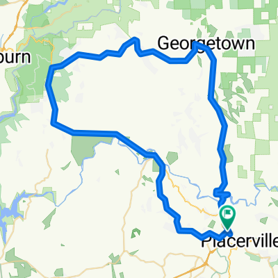
601 Main St, Placerville to 222 Main St, Placerville
A cycling route starting in Placerville, California, United States of America.
Overview
About this route
- 2 h 18 min
- Duration
- 30.7 km
- Distance
- 411 m
- Ascent
- 421 m
- Descent
- 13.3 km/h
- Avg. speed
- 867 m
- Avg. speed

Route quality
Waytypes & surfaces along the route
Waytypes
Cycleway
26.5 km
(86 %)
Busy road
1.6 km
(5 %)
Surfaces
Paved
29.6 km
(96 %)
Asphalt
15.7 km
(51 %)
Paved (undefined)
13.8 km
(45 %)
Continue with Bikemap
Use, edit, or download this cycling route
You would like to ride 601 Main St, Placerville to 222 Main St, Placerville or customize it for your own trip? Here is what you can do with this Bikemap route:
Free features
- Save this route as favorite or in collections
- Copy & plan your own version of this route
- Sync your route with Garmin or Wahoo
Premium features
Free trial for 3 days, or one-time payment. More about Bikemap Premium.
- Navigate this route on iOS & Android
- Export a GPX / KML file of this route
- Create your custom printout (try it for free)
- Download this route for offline navigation
Discover more Premium features.
Get Bikemap PremiumFrom our community
Other popular routes starting in Placerville
 Placerville to Polluck Pines
- Distance
- 25.4 km
- Ascent
- 901 m
- Descent
- 254 m
- Location
- Placerville, California, United States of America
 From Placerville back up
- Distance
- 9.4 km
- Ascent
- 372 m
- Descent
- 76 m
- Location
- Placerville, California, United States of America
 Placerville - Folsom
- Distance
- 66 km
- Ascent
- 410 m
- Descent
- 794 m
- Location
- Placerville, California, United States of America
 California 49 2565, Placerville to Deena Court 2488, Placerville
- Distance
- 75.2 km
- Ascent
- 1,592 m
- Descent
- 1,593 m
- Location
- Placerville, California, United States of America
 El Dorado Trail - Placerville to Folsom
- Distance
- 51.9 km
- Ascent
- 106 m
- Descent
- 543 m
- Location
- Placerville, California, United States of America
 601 Main St, Placerville to 222 Main St, Placerville
- Distance
- 30.7 km
- Ascent
- 411 m
- Descent
- 421 m
- Location
- Placerville, California, United States of America
 Bomise Way 2939, Placerville to Camino Heights Drive 2947
- Distance
- 9.3 km
- Ascent
- 232 m
- Descent
- 90 m
- Location
- Placerville, California, United States of America
 49-193 loop
- Distance
- 75.3 km
- Ascent
- 1,171 m
- Descent
- 1,171 m
- Location
- Placerville, California, United States of America
Open it in the app