

295–379 Rue du Prado, Fontaines-Saint-Martin à 571 Route des Prolières, Cailloux-sur-Fontaines
A cycling route starting in Fontaines-sur-Saône, Auvergne-Rhône-Alpes, France.
Overview
About this route
- 35 min
- Duration
- 10.2 km
- Distance
- 113 m
- Ascent
- 75 m
- Descent
- 17.6 km/h
- Avg. speed
- 227 m
- Avg. speed
Route quality
Waytypes & surfaces along the route
Waytypes
Quiet road
8.4 km
(82 %)
Pedestrian area
1.1 km
(11 %)
Surfaces
Paved
8.5 km
(83 %)
Unpaved
1.1 km
(11 %)
Asphalt
8.5 km
(83 %)
Gravel
0.7 km
(6 %)
Continue with Bikemap
Use, edit, or download this cycling route
You would like to ride 295–379 Rue du Prado, Fontaines-Saint-Martin à 571 Route des Prolières, Cailloux-sur-Fontaines or customize it for your own trip? Here is what you can do with this Bikemap route:
Free features
- Save this route as favorite or in collections
- Copy & plan your own version of this route
- Sync your route with Garmin or Wahoo
Premium features
Free trial for 3 days, or one-time payment. More about Bikemap Premium.
- Navigate this route on iOS & Android
- Export a GPX / KML file of this route
- Create your custom printout (try it for free)
- Download this route for offline navigation
Discover more Premium features.
Get Bikemap PremiumFrom our community
Other popular routes starting in Fontaines-sur-Saône
 Quai de la Libération, Collonges-au-Mont-d'Or to 5 Chemin de la Chaîne, Ternay
- Distance
- 30.1 km
- Ascent
- 243 m
- Descent
- 243 m
- Location
- Fontaines-sur-Saône, Auvergne-Rhône-Alpes, France
 Margot route
- Distance
- 54.6 km
- Ascent
- 286 m
- Descent
- 285 m
- Location
- Fontaines-sur-Saône, Auvergne-Rhône-Alpes, France
 L7 Abkürzung: Fontaines-Saint-Martin - Aurec-sur-Loire; 45+12km mit Bahn Givors-Firminy
- Distance
- 112.5 km
- Ascent
- 1,355 m
- Descent
- 1,099 m
- Location
- Fontaines-sur-Saône, Auvergne-Rhône-Alpes, France
 c1 Le circuit de Béa
- Distance
- 19.5 km
- Ascent
- 186 m
- Descent
- 183 m
- Location
- Fontaines-sur-Saône, Auvergne-Rhône-Alpes, France
 Frankreich mit Reiner Sept 2017
- Distance
- 1,373.2 km
- Ascent
- 5,998 m
- Descent
- 5,999 m
- Location
- Fontaines-sur-Saône, Auvergne-Rhône-Alpes, France
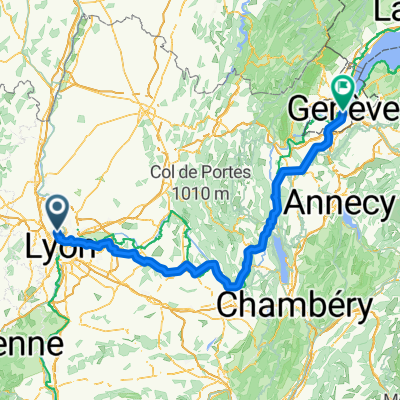 Saint Didier vers Genève
- Distance
- 189.5 km
- Ascent
- 966 m
- Descent
- 887 m
- Location
- Fontaines-sur-Saône, Auvergne-Rhône-Alpes, France
 Search the perimeter 2
- Distance
- 30 km
- Ascent
- 584 m
- Descent
- 583 m
- Location
- Fontaines-sur-Saône, Auvergne-Rhône-Alpes, France
 Fontaine-sur-Saône - Mâcon
- Distance
- 68.3 km
- Ascent
- 47 m
- Descent
- 42 m
- Location
- Fontaines-sur-Saône, Auvergne-Rhône-Alpes, France
Open it in the app