

ParcàParc 2
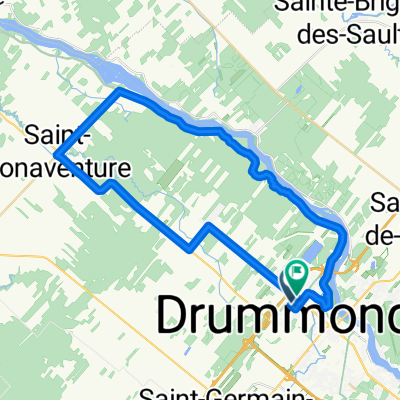
A cycling route starting in Drummondville, Quebec, Canada.
Overview
About this route
Itinéraire entre parc bordant rivière St-François Drummondville
- -:--
- Duration
- 11.7 km
- Distance
- 35 m
- Ascent
- 59 m
- Descent
- ---
- Avg. speed
- 107 m
- Avg. speed

Route quality
Waytypes & surfaces along the route
Waytypes
Road
9.7 km
(83 %)
Cycleway
1.5 km
(13 %)
Surfaces
Paved
11.2 km
(96 %)
Unpaved
0 km
(<1 %)
Asphalt
11.2 km
(96 %)
Unpaved (undefined)
0 km
(<1 %)
Undefined
0.4 km
(4 %)
Continue with Bikemap
Use, edit, or download this cycling route
You would like to ride ParcàParc 2 or customize it for your own trip? Here is what you can do with this Bikemap route:
Free features
- Save this route as favorite or in collections
- Copy & plan your own version of this route
- Sync your route with Garmin or Wahoo
Premium features
Free trial for 3 days, or one-time payment. More about Bikemap Premium.
- Navigate this route on iOS & Android
- Export a GPX / KML file of this route
- Create your custom printout (try it for free)
- Download this route for offline navigation
Discover more Premium features.
Get Bikemap PremiumFrom our community
Other popular routes starting in Drummondville
 ParcàParc 2
- Distance
- 11.7 km
- Ascent
- 35 m
- Descent
- 59 m
- Location
- Drummondville, Quebec, Canada
 Ch Golf Drummond
- Distance
- 44 km
- Ascent
- 105 m
- Descent
- 108 m
- Location
- Drummondville, Quebec, Canada
 Circuit vélo régional du Centre-du-Québec 3 Jours / The Regional Cycling Route 3 Days
- Distance
- 274.3 km
- Ascent
- 360 m
- Descent
- 360 m
- Location
- Drummondville, Quebec, Canada
 De 21 Av des Peupliers, Drummondville à 21 Av des Peupliers, Drummondville
- Distance
- 22.6 km
- Ascent
- 282 m
- Descent
- 280 m
- Location
- Drummondville, Quebec, Canada
 Short bike tour through Drummondville
- Distance
- 7.1 km
- Ascent
- 28 m
- Descent
- 28 m
- Location
- Drummondville, Quebec, Canada
 ParcàParc 1
- Distance
- 13.6 km
- Ascent
- 70 m
- Descent
- 55 m
- Location
- Drummondville, Quebec, Canada
 De Boulevard René-Lévesque 612, Drummondville à Chemin du Sanctuaire, Saint-Majorique
- Distance
- 10.4 km
- Ascent
- 39 m
- Descent
- 61 m
- Location
- Drummondville, Quebec, Canada
 Tour de piste
- Distance
- 49.2 km
- Ascent
- 92 m
- Descent
- 91 m
- Location
- Drummondville, Quebec, Canada
Open it in the app