

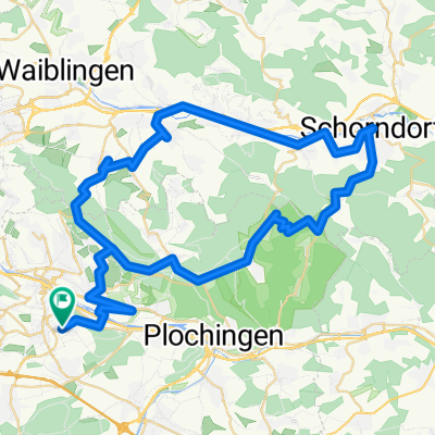
Marie-Curie-Straße 2, Denkendorf nach Achalmstraße 32, Ostfildern
A cycling route starting in Denkendorf, Baden-Württemberg, Germany.
Overview
About this route
- 4 h 30 min
- Duration
- 49.8 km
- Distance
- 316 m
- Ascent
- 374 m
- Descent
- 11.1 km/h
- Avg. speed
- 482 m
- Avg. speed

Route quality
Waytypes & surfaces along the route
Waytypes
Path
16.8 km
(34 %)
Pedestrian area
9.3 km
(19 %)
Surfaces
Paved
46.4 km
(93 %)
Unpaved
1.5 km
(3 %)
Asphalt
39.7 km
(80 %)
Paving stones
4.8 km
(10 %)
Continue with Bikemap
Use, edit, or download this cycling route
You would like to ride Marie-Curie-Straße 2, Denkendorf nach Achalmstraße 32, Ostfildern or customize it for your own trip? Here is what you can do with this Bikemap route:
Free features
- Save this route as favorite or in collections
- Copy & plan your own version of this route
- Sync your route with Garmin or Wahoo
Premium features
Free trial for 3 days, or one-time payment. More about Bikemap Premium.
- Navigate this route on iOS & Android
- Export a GPX / KML file of this route
- Create your custom printout (try it for free)
- Download this route for offline navigation
Discover more Premium features.
Get Bikemap PremiumFrom our community
Other popular routes starting in Denkendorf
 Radtour "Kraut & Rüben" - Rundtour über die Filderebene
- Distance
- 33 km
- Ascent
- 310 m
- Descent
- 308 m
- Location
- Denkendorf, Baden-Württemberg, Germany
 tour durchs remstal und umgebung
- Distance
- 74.7 km
- Ascent
- 842 m
- Descent
- 842 m
- Location
- Denkendorf, Baden-Württemberg, Germany
 Ins Büro
- Distance
- 15.4 km
- Ascent
- 176 m
- Descent
- 213 m
- Location
- Denkendorf, Baden-Württemberg, Germany
 Berkheim - Schorndorf - Berkheim
- Distance
- 54 km
- Ascent
- 629 m
- Descent
- 629 m
- Location
- Denkendorf, Baden-Württemberg, Germany
 MDF_ES06_Nellingen-Esslingen-Stetten-Weinstadt-Winterbach-Schlichten-Baiereck-Ebersbach-Reichenbach-Plochingen-Nellingen
- Distance
- 60.6 km
- Ascent
- 841 m
- Descent
- 902 m
- Location
- Denkendorf, Baden-Württemberg, Germany
 Ostfildern-Körschtal
- Distance
- 34.3 km
- Ascent
- 236 m
- Descent
- 236 m
- Location
- Denkendorf, Baden-Württemberg, Germany
 Siebenmühlental-Schaichtal
- Distance
- 62.7 km
- Ascent
- 519 m
- Descent
- 519 m
- Location
- Denkendorf, Baden-Württemberg, Germany
 Jägerhaus-Kappelberg-Grabkapelle
- Distance
- 34.7 km
- Ascent
- 543 m
- Descent
- 544 m
- Location
- Denkendorf, Baden-Württemberg, Germany
Open it in the app