

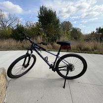
2030 CR-42 W, Burnsville to 3840 Clinton Ave, Minneapolis
A cycling route starting in Burnsville, Minnesota, United States.
Overview
About this route
- 1 h 26 min
- Duration
- 28.4 km
- Distance
- 97 m
- Ascent
- 148 m
- Descent
- 20 km/h
- Avg. speed
- 313 m
- Max. altitude

Route quality
Waytypes & surfaces along the route
Waytypes
Cycleway
13.4 km
(47 %)
Road
5.4 km
(19 %)
Surfaces
Paved
19.6 km
(69 %)
Asphalt
18.2 km
(64 %)
Concrete
1.1 km
(4 %)
Continue with Bikemap
Use, edit, or download this cycling route
You would like to ride 2030 CR-42 W, Burnsville to 3840 Clinton Ave, Minneapolis or customize it for your own trip? Here is what you can do with this Bikemap route:
Free features
- Save this route as favorite or in collections
- Copy & plan your own version of this route
- Sync your route with Garmin or Wahoo
Premium features
Free trial for 3 days, or one-time payment. More about Bikemap Premium.
- Navigate this route on iOS & Android
- Export a GPX / KML file of this route
- Create your custom printout (try it for free)
- Download this route for offline navigation
Discover more Premium features.
Get Bikemap PremiumFrom our community
Other popular routes starting in Burnsville
 Bloomington to Bluff Trail, Bloomington
- Distance
- 13.3 km
- Ascent
- 13 m
- Descent
- 9 m
- Location
- Burnsville, Minnesota, United States
 Black Dog Rd, Burnsville to Black Dog Rd, Burnsville
- Distance
- 11.7 km
- Ascent
- 9 m
- Descent
- 6 m
- Location
- Burnsville, Minnesota, United States
 B2B00769 55337>55102 via High Line Trl, Pilot Knob, Victoria Rd, Shepard Rd
- Distance
- 25.2 km
- Ascent
- 100 m
- Descent
- 170 m
- Location
- Burnsville, Minnesota, United States
 Black Dog Rd, Burnsville to Black Dog Rd, Burnsville
- Distance
- 12 km
- Ascent
- 3 m
- Descent
- 4 m
- Location
- Burnsville, Minnesota, United States
 Cannon Falls Lake Billsbey
- Distance
- 48.6 km
- Ascent
- 102 m
- Descent
- 130 m
- Location
- Burnsville, Minnesota, United States
 B2B00496 55337>55102 via Hwy 13, Bg Rvr Trl, Watter St
- Distance
- 23.9 km
- Ascent
- 180 m
- Descent
- 239 m
- Location
- Burnsville, Minnesota, United States
 Awesome training ride
- Distance
- 32.9 km
- Ascent
- 177 m
- Descent
- 174 m
- Location
- Burnsville, Minnesota, United States
 B2B00628 55337>55102 via Slater Rd, High Line Trl, Blackhawk Rd, Big Rivers Trl
- Distance
- 32.9 km
- Ascent
- 127 m
- Descent
- 187 m
- Location
- Burnsville, Minnesota, United States
Open it in the app