

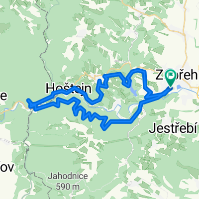
Háječkova 422/9, Zábřeh to Postřelmovská 410/9, Zábřeh
A cycling route starting in Zábřeh, Olomoucký kraj, Czechia.
Overview
About this route
- 2 h 21 min
- Duration
- 26.6 km
- Distance
- 280 m
- Ascent
- 281 m
- Descent
- 11.3 km/h
- Avg. speed
- 508 m
- Max. altitude

Route quality
Waytypes & surfaces along the route
Waytypes
Road
10.4 km
(39 %)
Track
5.6 km
(21 %)
Surfaces
Paved
5.1 km
(19 %)
Unpaved
4.8 km
(18 %)
Asphalt
4.8 km
(18 %)
Gravel
3.7 km
(14 %)
Continue with Bikemap
Use, edit, or download this cycling route
You would like to ride Háječkova 422/9, Zábřeh to Postřelmovská 410/9, Zábřeh or customize it for your own trip? Here is what you can do with this Bikemap route:
Free features
- Save this route as favorite or in collections
- Copy & plan your own version of this route
- Sync your route with Garmin or Wahoo
Premium features
Free trial for 3 days, or one-time payment. More about Bikemap Premium.
- Navigate this route on iOS & Android
- Export a GPX / KML file of this route
- Create your custom printout (try it for free)
- Download this route for offline navigation
Discover more Premium features.
Get Bikemap PremiumFrom our community
Other popular routes starting in Zábřeh
 Dolní Bušínov - Mírov a zpátky
- Distance
- 15.2 km
- Ascent
- 324 m
- Descent
- 324 m
- Location
- Zábřeh, Olomoucký kraj, Czechia
 Ze Zábřehu po zrušené trati dojedete do osady partyzánů
- Distance
- 14.9 km
- Ascent
- 175 m
- Descent
- 137 m
- Location
- Zábřeh, Olomoucký kraj, Czechia
 Zábřeh-Lázek-Zábřeh
- Distance
- 55.2 km
- Ascent
- 505 m
- Descent
- 503 m
- Location
- Zábřeh, Olomoucký kraj, Czechia
 Zbr-Brníčko-Hrabišín-Špk-Sudkov-Zbr
- Distance
- 34.7 km
- Ascent
- 130 m
- Descent
- 131 m
- Location
- Zábřeh, Olomoucký kraj, Czechia
 Welzlovo kolo "35"
- Distance
- 33.9 km
- Ascent
- 655 m
- Descent
- 660 m
- Location
- Zábřeh, Olomoucký kraj, Czechia
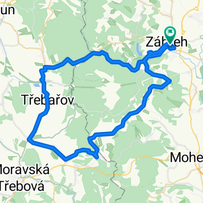
 Zbr-Kosov-Hoštejn-Zbr
- Distance
- 21.9 km
- Ascent
- 339 m
- Descent
- 339 m
- Location
- Zábřeh, Olomoucký kraj, Czechia
 Zbr-Maletín-Dolní Bušínov-Zbr
- Distance
- 30.4 km
- Ascent
- 468 m
- Descent
- 469 m
- Location
- Zábřeh, Olomoucký kraj, Czechia
 Zbr-Staré Město - Maletín-Zbr
- Distance
- 57 km
- Ascent
- 458 m
- Descent
- 458 m
- Location
- Zábřeh, Olomoucký kraj, Czechia
Open it in the app