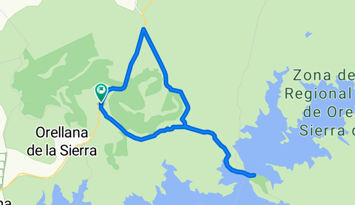
Cycling Route in Navalvillar de Pela, Extremadura, Spain
BCB. Moheda alta 4. Navalvillar de Pela - Puente del embalse de Orellana

Open this route in Bikemap Web
Distance
Ascent
Descent
Duration
Avg. Speed
Max. Elevation
Cycling Route in Navalvillar de Pela, Extremadura, Spain

Open this route in Bikemap Web
<span style="font-family: "Times New Roman","serif"; font-size: 10pt;"><span style="color: #000000;">Ruta de la Asociación Burgos Con Bici (BCB) por Extremadura. Abril 2009.</span></span>
<span style="font-family: "Times New Roman","serif"; font-size: 10pt;"><span style="color: #000000;"> </span></span>
<span style="font-family: "Times New Roman","serif"; font-size: 10pt;"><span style="color: #000000;">Ruta circular que se acerca al puente sobre el Embalse de Orellana. </span></span>
<span style="font-family: "Times New Roman","serif"; font-size: 10pt;"><span style="color: #000000;">Inicio cerca del puerto que une Navalvillar de Pela con Orellana (carretera autonómica Ex115). Hay espacio para aparcar varios coches en el punto de inicio (hay un cartel – panel de información sobre la zona).</span></span>
<span style="font-family: "Times New Roman","serif"; font-size: 10pt;"><span style="color: #000000;">Discurre por una pista de grava-tierra, a veces en mal estado. Para niños hay un par de tramos en bajada no aconsejables si pedalean solos.</span></span>
<span style="font-family: "Times New Roman","serif"; font-size: 10pt;"><span style="color: #000000;">En el regreso el recorrido propuesto va por un <span style="mso-spacerun: yes;"> </span>interesante camino en desuso y finaliza con un tramo en subida de la carretera autonómica Ex115. </span></span>
<span style="font-family: "Times New Roman","serif"; font-size: 10pt;"><span style="color: #000000;"> </span></span>
<span style="font-family: "Times New Roman","serif"; font-size: 10pt;"><span style="color: #000000;">No hay agua en todo el recorrido. </span></span>
<span style="font-family: "Times New Roman","serif"; font-size: 10pt;"><span style="color: #000000;">Intereses: </span></span>
<span style="font-family: "Times New Roman","serif"; font-size: 10pt;"><span style="color: #000000;"> </span></span>
<span style="font-family: "Times New Roman","serif"; font-size: 10pt;"><span style="color: #000000;">Zona recomendada para comer: en el brazo del embalse 1 km antes de llegar al puente del embalse de Orellana.</span></span>
Os recomendamos que activeis la vista en satélite en la pestaña "Terrain"
<div><br /></div>
You can use this route as a template in our cycling route planner so that you don’t have to start from scratch. Customize it based on your needs to plan your perfect cycling tour.