
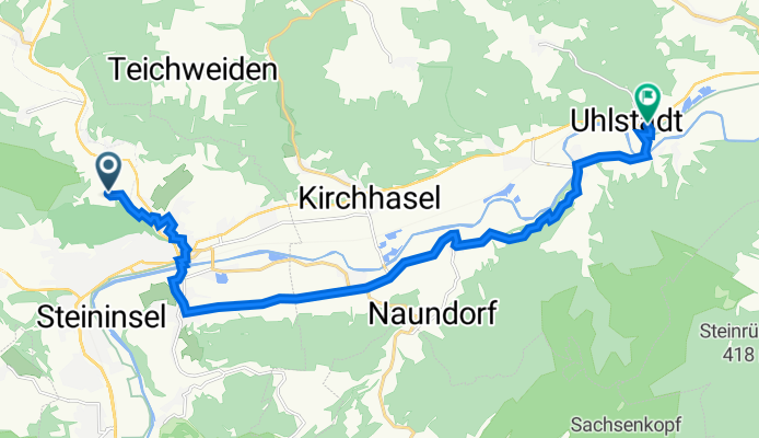
Rudolstadt nach Jenaische Straße 96, Uhlstädt-Kirchhasel
A cycling route starting in Rudolstadt, Free State of Thuringia, Germany.
Overview
About this route
- 1 h 6 min
- Duration
- 15.2 km
- Distance
- 167 m
- Ascent
- 244 m
- Descent
- 13.8 km/h
- Avg. speed
- 260 m
- Avg. speed

Route quality
Waytypes & surfaces along the route
Waytypes
Quiet road
6.4 km
(42 %)
Road
3.8 km
(25 %)
Surfaces
Paved
13.3 km
(88 %)
Unpaved
0.7 km
(5 %)
Asphalt
13.3 km
(87 %)
Unpaved (undefined)
0.5 km
(3 %)
Continue with Bikemap
Use, edit, or download this cycling route
You would like to ride Rudolstadt nach Jenaische Straße 96, Uhlstädt-Kirchhasel or customize it for your own trip? Here is what you can do with this Bikemap route:
Free features
- Save this route as favorite or in collections
- Copy & plan your own version of this route
- Sync your route with Garmin or Wahoo
Premium features
Free trial for 3 days, or one-time payment. More about Bikemap Premium.
- Navigate this route on iOS & Android
- Export a GPX / KML file of this route
- Create your custom printout (try it for free)
- Download this route for offline navigation
Discover more Premium features.
Get Bikemap PremiumFrom our community
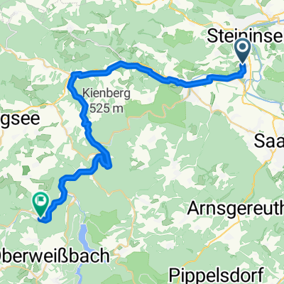
Other popular routes starting in Rudolstadt
 Ab durch den Wald.
- Distance
- 27.5 km
- Ascent
- 403 m
- Descent
- 405 m
- Location
- Rudolstadt, Free State of Thuringia, Germany
 Fröbelrundwanderweg
- Distance
- 27.3 km
- Ascent
- 432 m
- Descent
- 432 m
- Location
- Rudolstadt, Free State of Thuringia, Germany
 Fahrradtour RU-Rottenbach-Bergbahn
- Distance
- 29.3 km
- Ascent
- 380 m
- Descent
- 263 m
- Location
- Rudolstadt, Free State of Thuringia, Germany
 RU-Oberweissbach-Solsdorf II
- Distance
- 82.5 km
- Ascent
- 1,219 m
- Descent
- 1,219 m
- Location
- Rudolstadt, Free State of Thuringia, Germany
 MTB Tour 3
- Distance
- 25.5 km
- Ascent
- 439 m
- Descent
- 439 m
- Location
- Rudolstadt, Free State of Thuringia, Germany
 MTB Tour 4
- Distance
- 52 km
- Ascent
- 720 m
- Descent
- 723 m
- Location
- Rudolstadt, Free State of Thuringia, Germany
 Aufnahme vom 7. Juni 14:43
- Distance
- 51 km
- Ascent
- 554 m
- Descent
- 555 m
- Location
- Rudolstadt, Free State of Thuringia, Germany
 Auf dem Saale/Ilm und Klosterradweg
- Distance
- 53.5 km
- Ascent
- 462 m
- Descent
- 459 m
- Location
- Rudolstadt, Free State of Thuringia, Germany
Open it in the app