

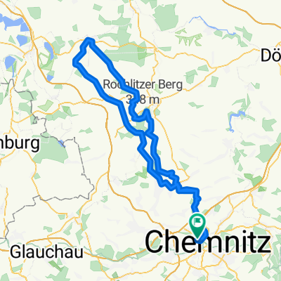
C-Wüstenbrand-Lugau_C
A cycling route starting in Chemnitz, Saxony, Germany.
Overview
About this route
lockere 2h-Runde
- -:--
- Duration
- 52.2 km
- Distance
- 279 m
- Ascent
- 279 m
- Descent
- ---
- Avg. speed
- 421 m
- Avg. speed

Route quality
Waytypes & surfaces along the route
Waytypes
Quiet road
15.4 km
(29 %)
Cycleway
14.7 km
(28 %)
Surfaces
Paved
48 km
(92 %)
Unpaved
2.2 km
(4 %)
Asphalt
48 km
(92 %)
Gravel
2.2 km
(4 %)
Undefined
2 km
(4 %)
Continue with Bikemap
Use, edit, or download this cycling route
You would like to ride C-Wüstenbrand-Lugau_C or customize it for your own trip? Here is what you can do with this Bikemap route:
Free features
- Save this route as favorite or in collections
- Copy & plan your own version of this route
- Sync your route with Garmin or Wahoo
Premium features
Free trial for 3 days, or one-time payment. More about Bikemap Premium.
- Navigate this route on iOS & Android
- Export a GPX / KML file of this route
- Create your custom printout (try it for free)
- Download this route for offline navigation
Discover more Premium features.
Get Bikemap PremiumFrom our community
Other popular routes starting in Chemnitz
 Chemnitz - Rochlitzer Berg - Bad Lausick - Chemnitz 2
- Distance
- 108.4 km
- Ascent
- 546 m
- Descent
- 543 m
- Location
- Chemnitz, Saxony, Germany
 Chemnitz - Kohren Salis
- Distance
- 96.3 km
- Ascent
- 522 m
- Descent
- 526 m
- Location
- Chemnitz, Saxony, Germany
 Goldner Hahn _ Wasserschloß
- Distance
- 34.3 km
- Ascent
- 670 m
- Descent
- 675 m
- Location
- Chemnitz, Saxony, Germany
 Abendrunde I
- Distance
- 30.6 km
- Ascent
- 218 m
- Descent
- 218 m
- Location
- Chemnitz, Saxony, Germany
 Raben-Toten-Hohen-stein-Runde
- Distance
- 41.4 km
- Ascent
- 393 m
- Descent
- 397 m
- Location
- Chemnitz, Saxony, Germany
 4h Runde Chemnitz
- Distance
- 107.7 km
- Ascent
- 582 m
- Descent
- 572 m
- Location
- Chemnitz, Saxony, Germany
 Zschopextreme
- Distance
- 47.7 km
- Ascent
- 675 m
- Descent
- 677 m
- Location
- Chemnitz, Saxony, Germany
 West- Nord- Runde (Grüna, Glöse, ...)
- Distance
- 49.8 km
- Ascent
- 339 m
- Descent
- 339 m
- Location
- Chemnitz, Saxony, Germany
Open it in the app