
Around Biggin Hill
A cycling route starting in Biggin Hill, England, United Kingdom.
Overview
About this route
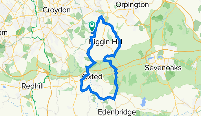
This is a great 50 km route around Biggin Hill. Easily reached from central London by train, there are many train stations that can be used as access points, East Croydon (6 miles away) probably the most frequent one. North Downs hills add the spice and some inclines offer a good challenge to anyone who looks for decent cycling around London. There could by many alterations of the route as country lanes (especially around Oxted and Westerham) give extra mileage route options.
- -:--
- Duration
- 50.1 km
- Distance
- 599 m
- Ascent
- 598 m
- Descent
- ---
- Avg. speed
- ---
- Avg. speed
Continue with Bikemap
Use, edit, or download this cycling route
You would like to ride Around Biggin Hill or customize it for your own trip? Here is what you can do with this Bikemap route:
Free features
- Save this route as favorite or in collections
- Copy & plan your own version of this route
- Sync your route with Garmin or Wahoo
Premium features
Free trial for 3 days, or one-time payment. More about Bikemap Premium.
- Navigate this route on iOS & Android
- Export a GPX / KML file of this route
- Create your custom printout (try it for free)
- Download this route for offline navigation
Discover more Premium features.
Get Bikemap PremiumFrom our community
Other popular routes starting in Biggin Hill
 311 Main Road, Westerham to London Road, Sevenoaks
- Distance
- 10.6 km
- Ascent
- 78 m
- Descent
- 208 m
- Location
- Biggin Hill, England, United Kingdom
 Hesiers Hill, Tandridge to 131 White Horse Lane, London
- Distance
- 28.2 km
- Ascent
- 76 m
- Descent
- 259 m
- Location
- Biggin Hill, England, United Kingdom
 285 Main Road, Westerham to 4A Stock Hill, Westerham
- Distance
- 15.1 km
- Ascent
- 155 m
- Descent
- 174 m
- Location
- Biggin Hill, England, United Kingdom
 Hayes, Edenbridge Loop
- Distance
- 59.5 km
- Ascent
- 589 m
- Descent
- 695 m
- Location
- Biggin Hill, England, United Kingdom
 Tatsfield short house walk
- Distance
- 2.4 km
- Ascent
- 20 m
- Descent
- 67 m
- Location
- Biggin Hill, England, United Kingdom
 Skid Hill Lane to Cherry Tree Walk 13
- Distance
- 10.3 km
- Ascent
- 17 m
- Descent
- 162 m
- Location
- Biggin Hill, England, United Kingdom
 Slow ride in London
- Distance
- 21.3 km
- Ascent
- 71 m
- Descent
- 242 m
- Location
- Biggin Hill, England, United Kingdom
 Jail Lane 142, Biggin Hill to Newlands Park 104
- Distance
- 19.3 km
- Ascent
- 499 m
- Descent
- 625 m
- Location
- Biggin Hill, England, United Kingdom
Open it in the app