

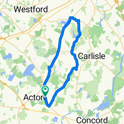
48 Brook St, Acton to 48 Brook St, Acton
A cycling route starting in Acton, Massachusetts, United States of America.
Overview
About this route
- 1 h 4 min
- Duration
- 24.2 km
- Distance
- 93 m
- Ascent
- 94 m
- Descent
- 22.6 km/h
- Avg. speed
- 74 m
- Avg. speed
Route quality
Waytypes & surfaces along the route
Waytypes
Cycleway
24.1 km
(100 %)
Access road
0.1 km
(<1 %)
Undefined
0 km
(<1 %)
Surfaces
Paved
24.1 km
(100 %)
Asphalt
24.1 km
(100 %)
Undefined
0.1 km
(<1 %)
Continue with Bikemap
Use, edit, or download this cycling route
You would like to ride 48 Brook St, Acton to 48 Brook St, Acton or customize it for your own trip? Here is what you can do with this Bikemap route:
Free features
- Save this route as favorite or in collections
- Copy & plan your own version of this route
- Sync your route with Garmin or Wahoo
Premium features
Free trial for 3 days, or one-time payment. More about Bikemap Premium.
- Navigate this route on iOS & Android
- Export a GPX / KML file of this route
- Create your custom printout (try it for free)
- Download this route for offline navigation
Discover more Premium features.
Get Bikemap PremiumFrom our community
Other popular routes starting in Acton
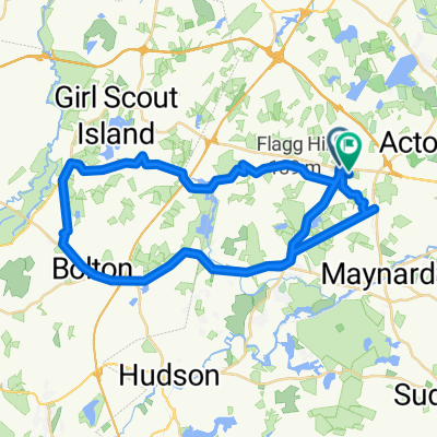
 Acton, Chelms, Carlisle
- Distance
- 25.5 km
- Ascent
- 133 m
- Descent
- 130 m
- Location
- Acton, Massachusetts, United States of America
 48 Brook St, Acton to 48 Brook St, Acton
- Distance
- 24.2 km
- Ascent
- 93 m
- Descent
- 94 m
- Location
- Acton, Massachusetts, United States of America
 15 mile Concord Carlisle Route
- Distance
- 22.8 km
- Ascent
- 119 m
- Descent
- 119 m
- Location
- Acton, Massachusetts, United States of America
 good uphill bike
- Distance
- 10.3 km
- Ascent
- 112 m
- Descent
- 54 m
- Location
- Acton, Massachusetts, United States of America
 Acton Harvard Loop With Mistakes
- Distance
- 52.5 km
- Ascent
- 269 m
- Descent
- 269 m
- Location
- Acton, Massachusetts, United States of America
 44 Washington Dr, Acton to 177 Newtown Rd, Acton
- Distance
- 91.8 km
- Ascent
- 321 m
- Descent
- 316 m
- Location
- Acton, Massachusetts, United States of America
 73 Esterbrook Rd, Acton to 88 Esterbrook Rd, Acton
- Distance
- 44.4 km
- Ascent
- 513 m
- Descent
- 514 m
- Location
- Acton, Massachusetts, United States of America
 BF Trail to Chelmsford
- Distance
- 50.9 km
- Ascent
- 138 m
- Descent
- 139 m
- Location
- Acton, Massachusetts, United States of America
Open it in the app