

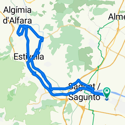
La bergonzosa
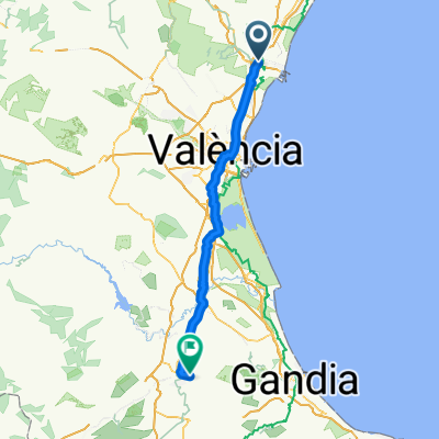
A cycling route starting in Sagunto, Valencia, Spain.
Overview
About this route
On this route, push as hard as you can at the border and at the Alt del Pi. Then you'll ride fast on the flat thanks to the strength you've gained from climbing.
- -:--
- Duration
- 57.9 km
- Distance
- 747 m
- Ascent
- 747 m
- Descent
- ---
- Avg. speed
- ---
- Max. altitude
Continue with Bikemap
Use, edit, or download this cycling route
You would like to ride La bergonzosa or customize it for your own trip? Here is what you can do with this Bikemap route:
Free features
- Save this route as favorite or in collections
- Copy & plan your own version of this route
- Sync your route with Garmin or Wahoo
Premium features
Free trial for 3 days, or one-time payment. More about Bikemap Premium.
- Navigate this route on iOS & Android
- Export a GPX / KML file of this route
- Create your custom printout (try it for free)
- Download this route for offline navigation
Discover more Premium features.
Get Bikemap PremiumFrom our community
Other popular routes starting in Sagunto
 Sagunt, Petrés, bosque ,sendas, fuente, barranco y Castillo
- Distance
- 21.8 km
- Ascent
- 445 m
- Descent
- 446 m
- Location
- Sagunto, Valencia, Spain
 Sagunto circular por Alfara y Torres Torres
- Distance
- 40.3 km
- Ascent
- 403 m
- Descent
- 402 m
- Location
- Sagunto, Valencia, Spain
 ALFORJAS POR CASTELLÓN
- Distance
- 344.1 km
- Ascent
- 3,486 m
- Descent
- 3,522 m
- Location
- Sagunto, Valencia, Spain
 Sagunto - Genovés
- Distance
- 96.3 km
- Ascent
- 413 m
- Descent
- 309 m
- Location
- Sagunto, Valencia, Spain
 Fernando 12
- Distance
- 153.1 km
- Ascent
- 1,259 m
- Descent
- 1,259 m
- Location
- Sagunto, Valencia, Spain
 La bergonzosa
- Distance
- 57.9 km
- Ascent
- 747 m
- Descent
- 747 m
- Location
- Sagunto, Valencia, Spain
 Sagunto - Antenas Picayo - Pico Aguila - Mola - Xocainet - Gilet -Sagunto
- Distance
- 34.7 km
- Ascent
- 709 m
- Descent
- 709 m
- Location
- Sagunto, Valencia, Spain
 puerto sagunto-aqüeducte dels arcs-torres torres-puerto sagunto-
- Distance
- 38.2 km
- Ascent
- 313 m
- Descent
- 310 m
- Location
- Sagunto, Valencia, Spain
Open it in the app