
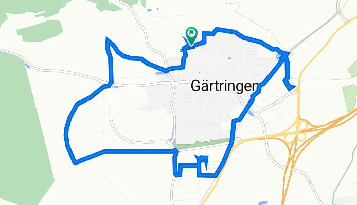
Thomas-Mann-Straße 14, Gärtringen nach Thomas-Mann-Straße 14, Gärtringen
A cycling route starting in Gärtringen, Baden-Württemberg, Germany.
Overview
About this route
- 1 h 47 min
- Duration
- 11.9 km
- Distance
- 139 m
- Ascent
- 139 m
- Descent
- 6.7 km/h
- Avg. speed
- 513 m
- Avg. speed

Route quality
Waytypes & surfaces along the route
Waytypes
Quiet road
3.2 km
(27 %)
Cycleway
2.4 km
(20 %)
Surfaces
Paved
11.8 km
(99 %)
Unpaved
0.1 km
(<1 %)
Asphalt
10.8 km
(91 %)
Paving stones
1 km
(9 %)
Continue with Bikemap
Use, edit, or download this cycling route
You would like to ride Thomas-Mann-Straße 14, Gärtringen nach Thomas-Mann-Straße 14, Gärtringen or customize it for your own trip? Here is what you can do with this Bikemap route:
Free features
- Save this route as favorite or in collections
- Copy & plan your own version of this route
- Sync your route with Garmin or Wahoo
Premium features
Free trial for 3 days, or one-time payment. More about Bikemap Premium.
- Navigate this route on iOS & Android
- Export a GPX / KML file of this route
- Create your custom printout (try it for free)
- Download this route for offline navigation
Discover more Premium features.
Get Bikemap PremiumFrom our community
Other popular routes starting in Gärtringen
 Gärtringen Krabbanescht in Holzbronn
- Distance
- 36.6 km
- Ascent
- 424 m
- Descent
- 422 m
- Location
- Gärtringen, Baden-Württemberg, Germany
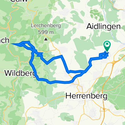
 Gärtringen - Deckenpfronn - Rohrau - Aidlingen
- Distance
- 43.2 km
- Ascent
- 349 m
- Descent
- 348 m
- Location
- Gärtringen, Baden-Württemberg, Germany
 Gärtringen - Sulz am Eck - Altdorf
- Distance
- 56.9 km
- Ascent
- 650 m
- Descent
- 668 m
- Location
- Gärtringen, Baden-Württemberg, Germany
 32km
32km- Distance
- 32.6 km
- Ascent
- 172 m
- Descent
- 171 m
- Location
- Gärtringen, Baden-Württemberg, Germany
 Test
Test- Distance
- 20.7 km
- Ascent
- 156 m
- Descent
- 156 m
- Location
- Gärtringen, Baden-Württemberg, Germany
 Gäurandtour
- Distance
- 67.4 km
- Ascent
- 451 m
- Descent
- 451 m
- Location
- Gärtringen, Baden-Württemberg, Germany
 zum Einstimmen in die Saison
- Distance
- 39.4 km
- Ascent
- 338 m
- Descent
- 337 m
- Location
- Gärtringen, Baden-Württemberg, Germany
 Gärtringen, Aidlingen, Dachtel
- Distance
- 16.2 km
- Ascent
- 406 m
- Descent
- 364 m
- Location
- Gärtringen, Baden-Württemberg, Germany
Open it in the app