
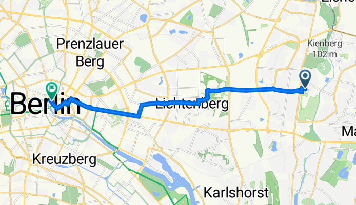
SS 2 S Wagner
A cycling route starting in Kaulsdorf, Land Berlin, Germany.
Overview
About this route
- 42 min
- Duration
- 13 km
- Distance
- 40 m
- Ascent
- 59 m
- Descent
- 18.7 km/h
- Avg. speed
- 60 m
- Avg. speed

Route quality
Waytypes & surfaces along the route
Waytypes
Quiet road
6 km
(46 %)
Cycleway
2.6 km
(20 %)
Surfaces
Paved
12.9 km
(99 %)
Asphalt
9.6 km
(74 %)
Concrete
2.8 km
(22 %)
Continue with Bikemap
Use, edit, or download this cycling route
You would like to ride SS 2 S Wagner or customize it for your own trip? Here is what you can do with this Bikemap route:
Free features
- Save this route as favorite or in collections
- Copy & plan your own version of this route
- Sync your route with Garmin or Wahoo
Premium features
Free trial for 3 days, or one-time payment. More about Bikemap Premium.
- Navigate this route on iOS & Android
- Export a GPX / KML file of this route
- Create your custom printout (try it for free)
- Download this route for offline navigation
Discover more Premium features.
Get Bikemap PremiumFrom our community
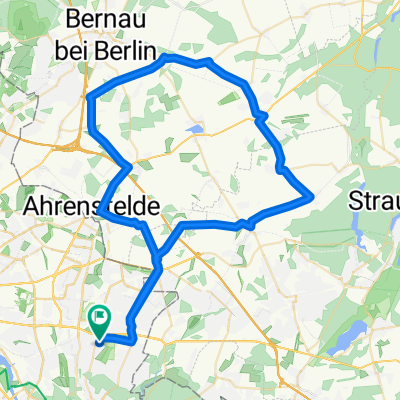
Other popular routes starting in Kaulsdorf
 Berlin-Regbg-A
- Distance
- 431.1 km
- Ascent
- 970 m
- Descent
- 625 m
- Location
- Kaulsdorf, Land Berlin, Germany
 De Teterower Ring 35, Berlin a Französische Straße 2, Berlin
- Distance
- 17 km
- Ascent
- 224 m
- Descent
- 235 m
- Location
- Kaulsdorf, Land Berlin, Germany
 Neujahrstour 2022
- Distance
- 47.1 km
- Ascent
- 176 m
- Descent
- 184 m
- Location
- Kaulsdorf, Land Berlin, Germany
 2014.06.20 Seniorenradeln
- Distance
- 32.2 km
- Ascent
- 68 m
- Descent
- 58 m
- Location
- Kaulsdorf, Land Berlin, Germany
 Kaulsdorf / Münchehofe / Vogelsdorf / Hönow / Kaulsdorf
- Distance
- 32 km
- Ascent
- 57 m
- Descent
- 46 m
- Location
- Kaulsdorf, Land Berlin, Germany
 Weg_Oma_Berlin
- Distance
- 0.8 km
- Ascent
- 0 m
- Descent
- 6 m
- Location
- Kaulsdorf, Land Berlin, Germany
 Bernauer Acht
- Distance
- 96.5 km
- Ascent
- 241 m
- Descent
- 235 m
- Location
- Kaulsdorf, Land Berlin, Germany
 Strecke Laurin 67 Km
- Distance
- 66.1 km
- Ascent
- 99 m
- Descent
- 96 m
- Location
- Kaulsdorf, Land Berlin, Germany
Open it in the app