

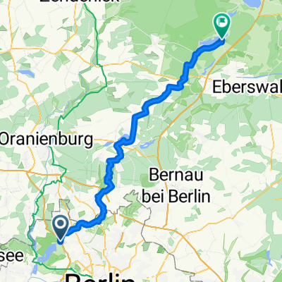
Schubartstraße 19, Berlin nach Stolpe, Hohen Neuendorf
A cycling route starting in Tegel, Land Berlin, Germany.
Overview
About this route
- 30 min
- Duration
- 7.7 km
- Distance
- 48 m
- Ascent
- 39 m
- Descent
- 15.7 km/h
- Avg. speed
- 66 m
- Avg. speed

Route quality
Waytypes & surfaces along the route
Waytypes
Track
3.4 km
(43 %)
Path
3.1 km
(40 %)
Surfaces
Paved
3.8 km
(49 %)
Unpaved
3.7 km
(48 %)
Asphalt
2.3 km
(30 %)
Ground
2 km
(26 %)
Continue with Bikemap
Use, edit, or download this cycling route
You would like to ride Schubartstraße 19, Berlin nach Stolpe, Hohen Neuendorf or customize it for your own trip? Here is what you can do with this Bikemap route:
Free features
- Save this route as favorite or in collections
- Copy & plan your own version of this route
- Sync your route with Garmin or Wahoo
Premium features
Free trial for 3 days, or one-time payment. More about Bikemap Premium.
- Navigate this route on iOS & Android
- Export a GPX / KML file of this route
- Create your custom printout (try it for free)
- Download this route for offline navigation
Discover more Premium features.
Get Bikemap PremiumFrom our community
Other popular routes starting in Tegel
 Freienhagen
- Distance
- 89.2 km
- Ascent
- 128 m
- Descent
- 128 m
- Location
- Tegel, Land Berlin, Germany
 2009 Sonntagstour Tegel ->Nordwärts Landstrasse
- Distance
- 74.9 km
- Ascent
- 148 m
- Descent
- 153 m
- Location
- Tegel, Land Berlin, Germany
 MTB Tour: Tegel > Eberswalde modified Tegel>Werbellinsee
- Distance
- 97.2 km
- Ascent
- 201 m
- Descent
- 199 m
- Location
- Tegel, Land Berlin, Germany
 Von Tegel nach Spandau
- Distance
- 12.4 km
- Ascent
- 14 m
- Descent
- 20 m
- Location
- Tegel, Land Berlin, Germany
 Tegel 6, viel Wald und ein Stück Mauerweg
- Distance
- 31.1 km
- Ascent
- 169 m
- Descent
- 166 m
- Location
- Tegel, Land Berlin, Germany
 Berlin - Mecklenburger Seenplatte
- Distance
- 211.7 km
- Ascent
- 651 m
- Descent
- 649 m
- Location
- Tegel, Land Berlin, Germany
 MTB Tour: Tegel > Werbellinsee
- Distance
- 64.8 km
- Ascent
- 167 m
- Descent
- 148 m
- Location
- Tegel, Land Berlin, Germany
 NordTour_Rundfahrt
- Distance
- 36.4 km
- Ascent
- 103 m
- Descent
- 97 m
- Location
- Tegel, Land Berlin, Germany
Open it in the app