

Camel Trail Circuit with a ferry
A cycling route starting in Wadebridge, England, United Kingdom.
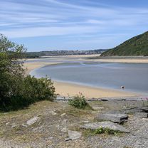
Overview
About this route
Mixture of the entire length of the Camel Trail (17 miles) where the surface is compacted china clay and grit, flat all the way and suitable for all (except maybe racing bikes) and then a hilly section on lanes, all paved.
Easiest to do this clockwise as the hill from Poolys Bridge (end of Camel trail) to St Tudy is 2 miles up hill. (or down if done clockwise!)
Lots of pubs and tea rooms on route
Good old traditional English pubs at St Tudy, Chapel Amble and St Kew
Parking at Padstow, Wadebridge, Dunmere, Helland Brdge. Bike hire at Wadebridge and Padstow
Padstow/Rock ferry bikes cost £1, runs every 15 mins during the summer, a bit less in the winter. daylight hours.
- -:--
- Duration
- 51.1 km
- Distance
- 365 m
- Ascent
- 365 m
- Descent
- ---
- Avg. speed
- ---
- Avg. speed
Continue with Bikemap
Use, edit, or download this cycling route
You would like to ride Camel Trail Circuit with a ferry or customize it for your own trip? Here is what you can do with this Bikemap route:
Free features
- Save this route as favorite or in collections
- Copy & plan your own version of this route
- Sync your route with Garmin or Wahoo
Premium features
Free trial for 3 days, or one-time payment. More about Bikemap Premium.
- Navigate this route on iOS & Android
- Export a GPX / KML file of this route
- Create your custom printout (try it for free)
- Download this route for offline navigation
Discover more Premium features.
Get Bikemap PremiumFrom our community
Other popular routes starting in Wadebridge
 Hamilton House, The Platt, Wadebridge to Padstow Quays, Station Road, Padstow
- Distance
- 10.1 km
- Ascent
- 103 m
- Descent
- 95 m
- Location
- Wadebridge, England, United Kingdom
 half way back
- Distance
- 6.7 km
- Ascent
- 93 m
- Descent
- 99 m
- Location
- Wadebridge, England, United Kingdom
 Wadebridge to The Borough Arms, Dunmere
- Distance
- 8.6 km
- Ascent
- 110 m
- Descent
- 147 m
- Location
- Wadebridge, England, United Kingdom
 LEJOG Day 2 Wadebridge to Tiverton
- Distance
- 168 km
- Ascent
- 903 m
- Descent
- 939 m
- Location
- Wadebridge, England, United Kingdom
 End to End - Day 02
- Distance
- 167.7 km
- Ascent
- 2,175 m
- Descent
- 2,160 m
- Location
- Wadebridge, England, United Kingdom
 Wadebridge Cycling
- Distance
- 56.7 km
- Ascent
- 916 m
- Descent
- 757 m
- Location
- Wadebridge, England, United Kingdom
 Jogle Day 14
- Distance
- 115.8 km
- Ascent
- 742 m
- Descent
- 787 m
- Location
- Wadebridge, England, United Kingdom
 Anneka Bridge to Market Strand 2
- Distance
- 9.8 km
- Ascent
- 3 m
- Descent
- 3 m
- Location
- Wadebridge, England, United Kingdom
Open it in the app