

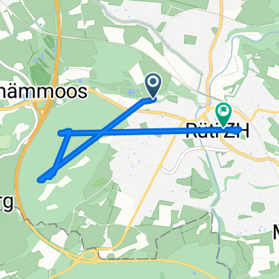
Recovered Route
A cycling route starting in Rüti / Westlicher Dorfteil, Canton of Zurich, Switzerland.
Overview
About this route
- 1 h 47 min
- Duration
- 41.6 km
- Distance
- 5,559 m
- Ascent
- 5,604 m
- Descent
- 23.3 km/h
- Avg. speed
- 528 m
- Avg. speed

Route quality
Waytypes & surfaces along the route
Waytypes
Path
12.7 km
(31 %)
Quiet road
9.1 km
(22 %)
Surfaces
Paved
33.5 km
(80 %)
Unpaved
3.6 km
(9 %)
Asphalt
31.9 km
(77 %)
Gravel
2.4 km
(6 %)
Continue with Bikemap
Use, edit, or download this cycling route
You would like to ride Recovered Route or customize it for your own trip? Here is what you can do with this Bikemap route:
Free features
- Save this route as favorite or in collections
- Copy & plan your own version of this route
- Sync your route with Garmin or Wahoo
Premium features
Free trial for 3 days, or one-time payment. More about Bikemap Premium.
- Navigate this route on iOS & Android
- Export a GPX / KML file of this route
- Create your custom printout (try it for free)
- Download this route for offline navigation
Discover more Premium features.
Get Bikemap PremiumFrom our community
Other popular routes starting in Rüti / Westlicher Dorfteil
 Einfache Fahrt in Grüningen
- Distance
- 13.5 km
- Ascent
- 241 m
- Descent
- 222 m
- Location
- Rüti / Westlicher Dorfteil, Canton of Zurich, Switzerland
 Ruti Feusisberg
- Distance
- 35.2 km
- Ascent
- 762 m
- Descent
- 549 m
- Location
- Rüti / Westlicher Dorfteil, Canton of Zurich, Switzerland
 Schwarz 8, Rüti nach Schulstrasse 7A, Rüti
- Distance
- 4.2 km
- Ascent
- 18 m
- Descent
- 3 m
- Location
- Rüti / Westlicher Dorfteil, Canton of Zurich, Switzerland
 Seefeldstrasse 6, Rüüti nach Spitalstrasse 66, Wetzike
- Distance
- 10.5 km
- Ascent
- 116 m
- Descent
- 36 m
- Location
- Rüti / Westlicher Dorfteil, Canton of Zurich, Switzerland
 Oberlandautobahn, Bubikon nach Laubisrütistrasse 57, Stäfa
- Distance
- 10.5 km
- Ascent
- 72 m
- Descent
- 109 m
- Location
- Rüti / Westlicher Dorfteil, Canton of Zurich, Switzerland
 Meine Trainings Wolfhausenpiste
- Distance
- 6.9 km
- Ascent
- 84 m
- Descent
- 84 m
- Location
- Rüti / Westlicher Dorfteil, Canton of Zurich, Switzerland
 Kleine Bachteltour
- Distance
- 22.5 km
- Ascent
- 902 m
- Descent
- 847 m
- Location
- Rüti / Westlicher Dorfteil, Canton of Zurich, Switzerland
 Recovered Route
- Distance
- 41.6 km
- Ascent
- 5,559 m
- Descent
- 5,604 m
- Location
- Rüti / Westlicher Dorfteil, Canton of Zurich, Switzerland