Premium Badge Download on the App Store Get it on Google Play Turn-by-turn Navigation Offline Maps Bike Type Optimized Routing Premium Maps Custom Bike Computer Export Routes Route Previews Fall Detection Premium Support

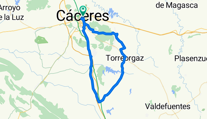
Cycling Route in Cáceres, Extremadura, Spain

CC - Sierra de Fuentes - Torre Orgaz - Aldea del Cano - Valdefuetes - CC

1
Open this route in the Bikemap app

Open this route in the Bikemap app

Open this route in Bikemap Web

Open this route in Bikemap Web

57 km
Distance
350 m
Ascent
347 m
Descent
-:-- h
Duration
-- km/h
Avg. Speed
--- m
Max. Elevation

About This Route

Ruta de dificultad baja-media.

Tiempo: 4 horas


Transcurre en su casi en su totalidad por caminos en buen estado.

En el km 8.5 hay una cancela que debemos abrir y cerrar.

This cycling route is ideal for: MTB

You will cycle on the following surfaces: Unpaved

Customize this cycling route with the Bikemap route planner.

Make it yours!

Did you know? You can use this route as a template in our cycling route planner if you don't wish to start from scratch. Customize it based on your needs to plan your perfect cycling tour.

Open it in the app