

Retour Normandie par Angers
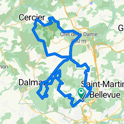
A cycling route starting in Pringy, Auvergne-Rhône-Alpes, France.
Overview
About this route
- 69 h 9 min
- Duration
- 1,064.2 km
- Distance
- 9,344 m
- Ascent
- 9,818 m
- Descent
- 15.4 km/h
- Avg. speed
- 1,195 m
- Avg. speed

Route quality
Waytypes & surfaces along the route
Waytypes
Road
398.7 km
(37 %)
Quiet road
292.5 km
(27 %)
Surfaces
Paved
444.9 km
(42 %)
Unpaved
57.4 km
(5 %)
Asphalt
406.4 km
(38 %)
Gravel
56.2 km
(5 %)
Continue with Bikemap
Use, edit, or download this cycling route
You would like to ride Retour Normandie par Angers or customize it for your own trip? Here is what you can do with this Bikemap route:
Free features
- Save this route as favorite or in collections
- Copy & plan your own version of this route
- Sync your route with Garmin or Wahoo
Premium features
Free trial for 3 days, or one-time payment. More about Bikemap Premium.
- Navigate this route on iOS & Android
- Export a GPX / KML file of this route
- Create your custom printout (try it for free)
- Download this route for offline navigation
Discover more Premium features.
Get Bikemap PremiumFrom our community
Other popular routes starting in Pringy
 Tour du lac
- Distance
- 49.1 km
- Ascent
- 442 m
- Descent
- 440 m
- Location
- Pringy, Auvergne-Rhône-Alpes, France
 De pringy à cercier- Mandallaz
- Distance
- 47.3 km
- Ascent
- 838 m
- Descent
- 828 m
- Location
- Pringy, Auvergne-Rhône-Alpes, France
 pringy mandallaz 2
- Distance
- 40.9 km
- Ascent
- 950 m
- Descent
- 950 m
- Location
- Pringy, Auvergne-Rhône-Alpes, France
 De Route du Président Lavy 615, Argonay à Route du Président Lavy 615, Argonay
- Distance
- 59.4 km
- Ascent
- 168 m
- Descent
- 377 m
- Location
- Pringy, Auvergne-Rhône-Alpes, France
 Avenue Marcel Dassault, Argonay à Impasse des Mésanges, Annecy
- Distance
- 5.8 km
- Ascent
- 31 m
- Descent
- 83 m
- Location
- Pringy, Auvergne-Rhône-Alpes, France
 acy viuz poisy
- Distance
- 52.9 km
- Ascent
- 822 m
- Descent
- 821 m
- Location
- Pringy, Auvergne-Rhône-Alpes, France
 444 Route de Pringy, 阿尔果奈 to D 27, 菲雷灵
- Distance
- 371.6 km
- Ascent
- 6,320 m
- Descent
- 5,630 m
- Location
- Pringy, Auvergne-Rhône-Alpes, France
 option 1
- Distance
- 50.4 km
- Ascent
- 662 m
- Descent
- 663 m
- Location
- Pringy, Auvergne-Rhône-Alpes, France
Open it in the app