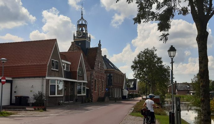
NL235: Von Callantsog zur verlorenen Küste
A cycling route starting in Schagen, North Holland, Netherlands.
Overview
About this route
Von Callantsoog geht es durch die Marsch mit ihren Deichen und Poldern in östliche Richtung nach Kolhorn. Kolhorn lag mit seinem kleinen Fischereihafen bis Mitte des 19. Jh. an der Zuiderzee, einer Meeresbucht der Nordsee. Nach der Durchführung von Landgewinnungsmaßnahmen entstanden Polder, die rasch trockengelegt und von Bauern besiedelt wurden. Heute liegt Kolhorn ca. 17 km von der Küste entfernt. Im sehenswerten Kern befinden sich noch zahlreiche Häuser der ehemaligen Fischer, die sich klein und geduckt eng aneinander drängen. Kolhorn zählt zu den schönsten Dörfern Nordhollands.
- -:--
- Duration
- 36 km
- Distance
- 7 m
- Ascent
- 9 m
- Descent
- ---
- Avg. speed
- 7 m
- Avg. speed
Route photos
Route quality
Waytypes & surfaces along the route
Waytypes
Cycleway
20.1 km
(56 %)
Road
10 km
(28 %)
Surfaces
Paved
8.4 km
(23 %)
Asphalt
7.1 km
(20 %)
Paved (undefined)
1.3 km
(4 %)
Undefined
27.6 km
(77 %)
Continue with Bikemap
Use, edit, or download this cycling route
You would like to ride NL235: Von Callantsog zur verlorenen Küste or customize it for your own trip? Here is what you can do with this Bikemap route:
Free features
- Save this route as favorite or in collections
- Copy & plan your own version of this route
- Sync your route with Garmin or Wahoo
Premium features
Free trial for 3 days, or one-time payment. More about Bikemap Premium.
- Navigate this route on iOS & Android
- Export a GPX / KML file of this route
- Create your custom printout (try it for free)
- Download this route for offline navigation
Discover more Premium features.
Get Bikemap PremiumFrom our community
Other popular routes starting in Schagen
 Rund um Schagen
- Distance
- 52.9 km
- Ascent
- 10 m
- Descent
- 11 m
- Location
- Schagen, North Holland, Netherlands
 NL225: Rund um Schagen
- Distance
- 34.8 km
- Ascent
- 11 m
- Descent
- 12 m
- Location
- Schagen, North Holland, Netherlands
 Callandsoog
- Distance
- 5.6 km
- Ascent
- 34 m
- Descent
- 34 m
- Location
- Schagen, North Holland, Netherlands
 Den Helder Tour
- Distance
- 30.2 km
- Ascent
- 28 m
- Descent
- 27 m
- Location
- Schagen, North Holland, Netherlands
 Easy ride in Sint Maartensvlotbrug
- Distance
- 24.3 km
- Ascent
- 32 m
- Descent
- 32 m
- Location
- Schagen, North Holland, Netherlands
 Callantsoog-Wieringerwaard-Kohlhorn 60km
- Distance
- 60 km
- Ascent
- 10 m
- Descent
- 10 m
- Location
- Schagen, North Holland, Netherlands
 Callandsoog 10/2019
- Distance
- 9.5 km
- Ascent
- 48 m
- Descent
- 46 m
- Location
- Schagen, North Holland, Netherlands
 NL234: Zum holländischen Nordkap - Den Helder
- Distance
- 39.1 km
- Ascent
- 84 m
- Descent
- 84 m
- Location
- Schagen, North Holland, Netherlands
Open it in the app


