
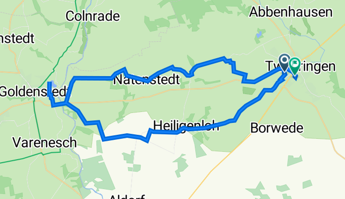
Beim Schlatt 29, Twistringen nach Konrad-Adenauer-Straße 14, Twistringen
A cycling route starting in Twistringen, Lower Saxony, Germany.
Overview
About this route
- 4 h 26 min
- Duration
- 35.5 km
- Distance
- 252 m
- Ascent
- 208 m
- Descent
- 8 km/h
- Avg. speed
- 98 m
- Avg. speed

Route quality
Waytypes & surfaces along the route
Waytypes
Quiet road
18.3 km
(52 %)
Path
7.8 km
(22 %)
Surfaces
Paved
27.2 km
(77 %)
Unpaved
3.3 km
(9 %)
Asphalt
21.1 km
(60 %)
Paving stones
5.9 km
(17 %)
Continue with Bikemap
Use, edit, or download this cycling route
You would like to ride Beim Schlatt 29, Twistringen nach Konrad-Adenauer-Straße 14, Twistringen or customize it for your own trip? Here is what you can do with this Bikemap route:
Free features
- Save this route as favorite or in collections
- Copy & plan your own version of this route
- Sync your route with Garmin or Wahoo
Premium features
Free trial for 3 days, or one-time payment. More about Bikemap Premium.
- Navigate this route on iOS & Android
- Export a GPX / KML file of this route
- Create your custom printout (try it for free)
- Download this route for offline navigation
Discover more Premium features.
Get Bikemap PremiumFrom our community
Other popular routes starting in Twistringen
 Twistringen1
- Distance
- 13.4 km
- Ascent
- 26 m
- Descent
- 28 m
- Location
- Twistringen, Lower Saxony, Germany
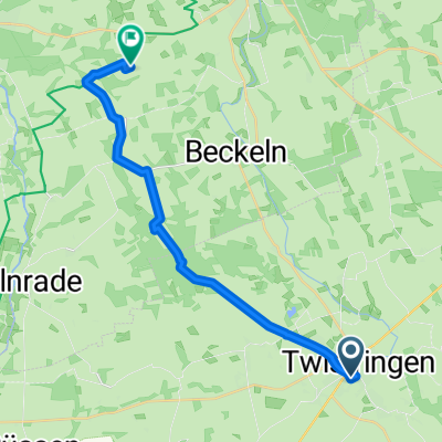
 Twistringen-Goldenstedt-Dinklage
- Distance
- 58 km
- Ascent
- 63 m
- Descent
- 88 m
- Location
- Twistringen, Lower Saxony, Germany
 Twistringen-Vechta(Stoppelmarkt)
- Distance
- 29.6 km
- Ascent
- 55 m
- Descent
- 62 m
- Location
- Twistringen, Lower Saxony, Germany
 Moderate Route in
- Distance
- 39.1 km
- Ascent
- 198 m
- Descent
- 213 m
- Location
- Twistringen, Lower Saxony, Germany
 Alte Ziegelei
- Distance
- 13.7 km
- Ascent
- 37 m
- Descent
- 37 m
- Location
- Twistringen, Lower Saxony, Germany
 (1)Tw-EssgBarjenbruchBikemap
- Distance
- 17 km
- Ascent
- 41 m
- Descent
- 59 m
- Location
- Twistringen, Lower Saxony, Germany
 neuenmarhorst-dehmse-köbbinghausen-twistringen
- Distance
- 15.1 km
- Ascent
- 54 m
- Descent
- 52 m
- Location
- Twistringen, Lower Saxony, Germany
 Twistringen R62
- Distance
- 61.4 km
- Ascent
- 180 m
- Descent
- 181 m
- Location
- Twistringen, Lower Saxony, Germany
Open it in the app