
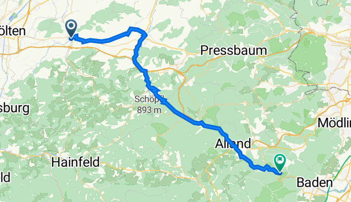
Hochfeldstraße 5, Böheimkirchen nach Krainerhütte, Rosental
A cycling route starting in Böheimkirchen, Lower Austria, Austria.
Overview
About this route
- 3 h 39 min
- Duration
- 49.6 km
- Distance
- 659 m
- Ascent
- 625 m
- Descent
- 13.6 km/h
- Avg. speed
- 591 m
- Avg. speed
Route quality
Waytypes & surfaces along the route
Waytypes
Quiet road
14.1 km
(28 %)
Busy road
9.5 km
(19 %)
Surfaces
Paved
35 km
(70 %)
Unpaved
2.5 km
(5 %)
Asphalt
32.5 km
(66 %)
Paved (undefined)
1.8 km
(4 %)
Continue with Bikemap
Use, edit, or download this cycling route
You would like to ride Hochfeldstraße 5, Böheimkirchen nach Krainerhütte, Rosental or customize it for your own trip? Here is what you can do with this Bikemap route:
Free features
- Save this route as favorite or in collections
- Copy & plan your own version of this route
- Sync your route with Garmin or Wahoo
Premium features
Free trial for 3 days, or one-time payment. More about Bikemap Premium.
- Navigate this route on iOS & Android
- Export a GPX / KML file of this route
- Create your custom printout (try it for free)
- Download this route for offline navigation
Discover more Premium features.
Get Bikemap PremiumFrom our community
Other popular routes starting in Böheimkirchen
 Böheimkirchen- Obergrafendorf- Loosdorf-Hohenegg-Böheimkirchen
- Distance
- 82.6 km
- Ascent
- 361 m
- Descent
- 361 m
- Location
- Böheimkirchen, Lower Austria, Austria
 Abendrunde zur Andreas-Friedenswarte
- Distance
- 16.2 km
- Ascent
- 122 m
- Descent
- 122 m
- Location
- Böheimkirchen, Lower Austria, Austria
 Böheimkirchen Pyhra Pottenbrunn
- Distance
- 28.9 km
- Ascent
- 223 m
- Descent
- 223 m
- Location
- Böheimkirchen, Lower Austria, Austria
 Easy Mittwoch Route In Böheimkirchen
- Distance
- 7.9 km
- Ascent
- 26 m
- Descent
- 20 m
- Location
- Böheimkirchen, Lower Austria, Austria
 Böheimkirchen-Gölsen Runde
- Distance
- 57.2 km
- Ascent
- 376 m
- Descent
- 374 m
- Location
- Böheimkirchen, Lower Austria, Austria
 Bahnhof Böheimkirchen - Perschlingtalradweg - Tulln an der Donau
- Distance
- 41.9 km
- Ascent
- 135 m
- Descent
- 204 m
- Location
- Böheimkirchen, Lower Austria, Austria
 Nußbach - Wien 3ter von 3 Tagen
- Distance
- 49.6 km
- Ascent
- 224 m
- Descent
- 275 m
- Location
- Böheimkirchen, Lower Austria, Austria
 Böheimkirchen, St. Pölten
- Distance
- 29.2 km
- Ascent
- 107 m
- Descent
- 111 m
- Location
- Böheimkirchen, Lower Austria, Austria
Open it in the app