

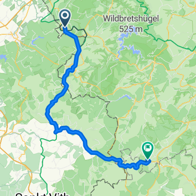
Walheim - Viadukt Moresnet
A cycling route starting in Roetgen, North Rhine-Westphalia, Germany.
Overview
About this route
- -:--
- Duration
- 45.8 km
- Distance
- 457 m
- Ascent
- 454 m
- Descent
- ---
- Avg. speed
- 309 m
- Max. altitude

Route quality
Waytypes & surfaces along the route
Waytypes
Road
17.9 km
(39 %)
Quiet road
16.5 km
(36 %)
Surfaces
Paved
37.5 km
(82 %)
Unpaved
0.5 km
(1 %)
Asphalt
36.6 km
(80 %)
Paved (undefined)
0.5 km
(1 %)
Continue with Bikemap
Use, edit, or download this cycling route
You would like to ride Walheim - Viadukt Moresnet or customize it for your own trip? Here is what you can do with this Bikemap route:
Free features
- Save this route as favorite or in collections
- Copy & plan your own version of this route
- Sync your route with Garmin or Wahoo
Premium features
Free trial for 3 days, or one-time payment. More about Bikemap Premium.
- Navigate this route on iOS & Android
- Export a GPX / KML file of this route
- Create your custom printout (try it for free)
- Download this route for offline navigation
Discover more Premium features.
Get Bikemap PremiumFrom our community
Other popular routes starting in Roetgen
 Acht Talsperren
- Distance
- 125.3 km
- Ascent
- 915 m
- Descent
- 915 m
- Location
- Roetgen, North Rhine-Westphalia, Germany
 Kleine Vennrunde von und bis Roetgen
- Distance
- 30.7 km
- Ascent
- 338 m
- Descent
- 338 m
- Location
- Roetgen, North Rhine-Westphalia, Germany
 Hügelige schöne Laufroute an der Ficht und im Wald
- Distance
- 3.7 km
- Ascent
- 41 m
- Descent
- 5 m
- Location
- Roetgen, North Rhine-Westphalia, Germany
 Um Eupen in die Ardennen
- Distance
- 106.6 km
- Ascent
- 829 m
- Descent
- 831 m
- Location
- Roetgen, North Rhine-Westphalia, Germany
 L2563 (48 - Vennbahn) Walheim - Aachen
- Distance
- 12.9 km
- Ascent
- 63 m
- Descent
- 152 m
- Location
- Roetgen, North Rhine-Westphalia, Germany
 Von Roetgen ins hohe Venn
- Distance
- 24 km
- Ascent
- 246 m
- Descent
- 267 m
- Location
- Roetgen, North Rhine-Westphalia, Germany
 Lammerskreuzstraße, Roetgen nach Burgbering, Dahlem
- Distance
- 63.9 km
- Ascent
- 763 m
- Descent
- 640 m
- Location
- Roetgen, North Rhine-Westphalia, Germany
 Vennbahnweg nach Philipsstraße
- Distance
- 21.8 km
- Ascent
- 44 m
- Descent
- 226 m
- Location
- Roetgen, North Rhine-Westphalia, Germany
Open it in the app