

Palm Desert to the top of Pines to Palms Highway
A cycling route starting in Palm Desert, California, United States of America.
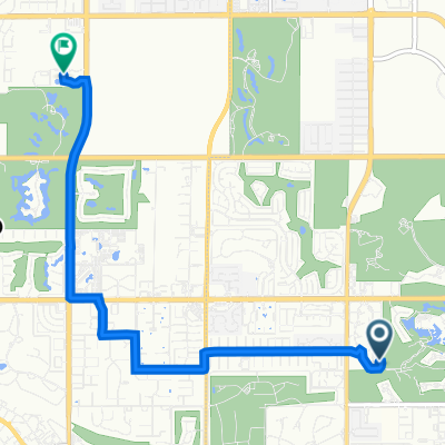
Overview
About this route
Caution urged! After the first 5km, there is no (ZERO) paved shoulder.
- -:--
- Duration
- 44.2 km
- Distance
- 1,460 m
- Ascent
- 154 m
- Descent
- ---
- Avg. speed
- ---
- Avg. speed
Route quality
Waytypes & surfaces along the route
Waytypes
Busy road
29 km
(66 %)
Quiet road
13.1 km
(30 %)
Surfaces
Paved
34.7 km
(78 %)
Unpaved
1.6 km
(4 %)
Asphalt
34.7 km
(78 %)
Unpaved (undefined)
1.6 km
(4 %)
Undefined
8 km
(18 %)
Continue with Bikemap
Use, edit, or download this cycling route
You would like to ride Palm Desert to the top of Pines to Palms Highway or customize it for your own trip? Here is what you can do with this Bikemap route:
Free features
- Save this route as favorite or in collections
- Copy & plan your own version of this route
- Sync your route with Garmin or Wahoo
Premium features
Free trial for 3 days, or one-time payment. More about Bikemap Premium.
- Navigate this route on iOS & Android
- Export a GPX / KML file of this route
- Create your custom printout (try it for free)
- Download this route for offline navigation
Discover more Premium features.
Get Bikemap PremiumFrom our community
Other popular routes starting in Palm Desert
 Willow Ridge, Palm Desert to 78495 Calle Tampico, La Quinta
- Distance
- 17.2 km
- Ascent
- 35 m
- Descent
- 93 m
- Location
- Palm Desert, California, United States of America
 40959 Sonata Ct, Palm Desert to 40959 Sonata Ct, Palm Desert
- Distance
- 24.3 km
- Ascent
- 419 m
- Descent
- 417 m
- Location
- Palm Desert, California, United States of America
 111 Verde Way, Palm Desert to 37977 Bob Hope Dr, Rancho Mirage
- Distance
- 7.7 km
- Ascent
- 35 m
- Descent
- 6 m
- Location
- Palm Desert, California, United States of America
 Flat & Easy Spin Day
- Distance
- 37.4 km
- Ascent
- 120 m
- Descent
- 119 m
- Location
- Palm Desert, California, United States of America
 74600 CA-111 N, Palm Desert to 44600 Indian Wells Ln, Indian Wells
- Distance
- 10.2 km
- Ascent
- 26 m
- Descent
- 49 m
- Location
- Palm Desert, California, United States of America
 113 Verde Way, Palm Desert to 113 Verde Way, Palm Desert
- Distance
- 20.8 km
- Ascent
- 77 m
- Descent
- 76 m
- Location
- Palm Desert, California, United States of America
 Route to N Civic Dr, Palm Springs
- Distance
- 18.8 km
- Ascent
- 110 m
- Descent
- 37 m
- Location
- Palm Desert, California, United States of America
 LaQuinta Cove visit
- Distance
- 54.1 km
- Ascent
- 216 m
- Descent
- 219 m
- Location
- Palm Desert, California, United States of America
Open it in the app