

Marktoberdorf - Auerberg - Marktoberdorf
A cycling route starting in Marktoberdorf, Bavaria, Germany.
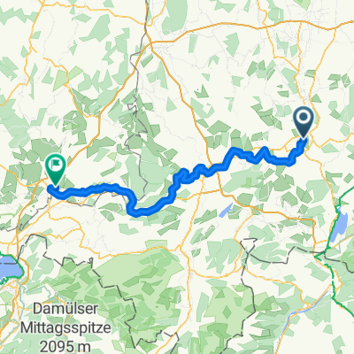
Overview
About this route
Von Stötten bis Weghof, Abfahrt Winkel stramme Steigung. Der Ausblick entlohnt für die Mühen.
- -:--
- Duration
- 36.4 km
- Distance
- 395 m
- Ascent
- 401 m
- Descent
- ---
- Avg. speed
- 941 m
- Avg. speed
Route quality
Waytypes & surfaces along the route
Waytypes
Quiet road
19.6 km
(54 %)
Busy road
6.2 km
(17 %)
Surfaces
Paved
18.8 km
(52 %)
Unpaved
0.8 km
(2 %)
Asphalt
15.9 km
(44 %)
Paved (undefined)
3 km
(8 %)
Continue with Bikemap
Use, edit, or download this cycling route
You would like to ride Marktoberdorf - Auerberg - Marktoberdorf or customize it for your own trip? Here is what you can do with this Bikemap route:
Free features
- Save this route as favorite or in collections
- Copy & plan your own version of this route
- Sync your route with Garmin or Wahoo
Premium features
Free trial for 3 days, or one-time payment. More about Bikemap Premium.
- Navigate this route on iOS & Android
- Export a GPX / KML file of this route
- Create your custom printout (try it for free)
- Download this route for offline navigation
Discover more Premium features.
Get Bikemap PremiumFrom our community
Other popular routes starting in Marktoberdorf
 MOD-Forggensee-Hopfensee-MOD
- Distance
- 85.7 km
- Ascent
- 787 m
- Descent
- 788 m
- Location
- Marktoberdorf, Bavaria, Germany
 10.06.07 Marktoberdorf-Wangen/Allgäu 3. Etappe zum Bodensee
- Distance
- 98.3 km
- Ascent
- 503 m
- Descent
- 630 m
- Location
- Marktoberdorf, Bavaria, Germany
 MOD-Runde
- Distance
- 47.8 km
- Ascent
- 293 m
- Descent
- 290 m
- Location
- Marktoberdorf, Bavaria, Germany
 Marktoberdorf-Füssen bzw. Dampflok-Runde
- Distance
- 121.9 km
- Ascent
- 1,609 m
- Descent
- 1,614 m
- Location
- Marktoberdorf, Bavaria, Germany
 MOD - Sachensr Bähnle - Weichberg - MOD
- Distance
- 53.5 km
- Ascent
- 504 m
- Descent
- 504 m
- Location
- Marktoberdorf, Bavaria, Germany
 Sulzschneider Forst
- Distance
- 30.1 km
- Ascent
- 190 m
- Descent
- 190 m
- Location
- Marktoberdorf, Bavaria, Germany
 MOD-Rettenbach
- Distance
- 31.4 km
- Ascent
- 341 m
- Descent
- 340 m
- Location
- Marktoberdorf, Bavaria, Germany
 MOD - 48 km - Wittwe-Bolte-Weiher - Kessa -MOD
- Distance
- 48.3 km
- Ascent
- 277 m
- Descent
- 277 m
- Location
- Marktoberdorf, Bavaria, Germany
Open it in the app