

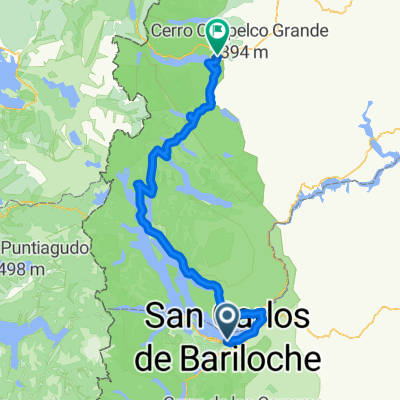
Circuito SC Brlch EBlsn
A cycling route starting in Bariloche, Río Negro Province, Argentina.
Overview
About this route
- -:--
- Duration
- 137.6 km
- Distance
- 2,262 m
- Ascent
- 2,742 m
- Descent
- ---
- Avg. speed
- 1,076 m
- Avg. speed

Route quality
Waytypes & surfaces along the route
Waytypes
Cycleway
72.3 km
(53 %)
Busy road
30.6 km
(22 %)
Surfaces
Paved
110 km
(80 %)
Unpaved
21.4 km
(16 %)
Asphalt
106 km
(77 %)
Unpaved (undefined)
9.9 km
(7 %)
Route highlights
Points of interest along the route
Photo after 47.5 km
Primera parada técnica en mirador Lago Mascardi a 45.5 km (20 minutos)
Photo after 71.6 km
Parada Foto en Cartel de Cañadón de la Mosca. (71 km)
Photo after 79.9 km
Parada toma foto del Pje. Villegas.(79 km)
Point of interest after 90 km
Segunda parada técnica Parador El Foyel, a los 90 km. (Almuerzo aproximadamente 1 hora)
Photo after 90.8 km
Mirador de Pitoy y cartel de El Foyel. (90 km)
Photo after 131.5 km
Parada de llegada a Destino en cartel de Capital Nacional del Lúpulo (132 km)
Continue with Bikemap
Use, edit, or download this cycling route
You would like to ride Circuito SC Brlch EBlsn or customize it for your own trip? Here is what you can do with this Bikemap route:
Free features
- Save this route as favorite or in collections
- Copy & plan your own version of this route
- Sync your route with Garmin or Wahoo
Premium features
Free trial for 3 days, or one-time payment. More about Bikemap Premium.
- Navigate this route on iOS & Android
- Export a GPX / KML file of this route
- Create your custom printout (try it for free)
- Download this route for offline navigation
Discover more Premium features.
Get Bikemap PremiumFrom our community
Other popular routes starting in Bariloche
 Bariloche - siete lagos - chile
- Distance
- 283.2 km
- Ascent
- 1,906 m
- Descent
- 2,095 m
- Location
- Bariloche, Río Negro Province, Argentina
 4 dias 7 lagos
- Distance
- 206.1 km
- Ascent
- 1,169 m
- Descent
- 1,292 m
- Location
- Bariloche, Río Negro Province, Argentina
 Bariloche - Lago Mascardi
- Distance
- 48.4 km
- Ascent
- 381 m
- Descent
- 339 m
- Location
- Bariloche, Río Negro Province, Argentina
 Cerro Otto
- Distance
- 7.6 km
- Ascent
- 537 m
- Descent
- 65 m
- Location
- Bariloche, Río Negro Province, Argentina
 Picada 7
- Distance
- 15.8 km
- Ascent
- 665 m
- Descent
- 760 m
- Location
- Bariloche, Río Negro Province, Argentina
 Paquito
- Distance
- 16.1 km
- Ascent
- 483 m
- Descent
- 484 m
- Location
- Bariloche, Río Negro Province, Argentina
 Bariloche - El Bolsón
- Distance
- 120.4 km
- Ascent
- 958 m
- Descent
- 1,486 m
- Location
- Bariloche, Río Negro Province, Argentina
 Bariloche(ARGENTINA) - Coñaripe(CHILE)
- Distance
- 465.4 km
- Ascent
- 1,719 m
- Descent
- 2,281 m
- Location
- Bariloche, Río Negro Province, Argentina
Open it in the app