

mooskirchen
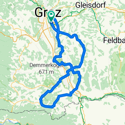
A cycling route starting in Feldkirchen bei Graz, Styria, Austria.
Overview
About this route
- -:--
- Duration
- 46.8 km
- Distance
- 507 m
- Ascent
- 506 m
- Descent
- ---
- Avg. speed
- 525 m
- Avg. speed
Route quality
Waytypes & surfaces along the route
Waytypes
Quiet road
23.9 km
(51 %)
Busy road
10.5 km
(23 %)
Surfaces
Paved
18.7 km
(40 %)
Unpaved
2.3 km
(5 %)
Asphalt
17.2 km
(37 %)
Paved (undefined)
1.4 km
(3 %)
Continue with Bikemap
Use, edit, or download this cycling route
You would like to ride mooskirchen or customize it for your own trip? Here is what you can do with this Bikemap route:
Free features
- Save this route as favorite or in collections
- Copy & plan your own version of this route
- Sync your route with Garmin or Wahoo
Premium features
Free trial for 3 days, or one-time payment. More about Bikemap Premium.
- Navigate this route on iOS & Android
- Export a GPX / KML file of this route
- Create your custom printout (try it for free)
- Download this route for offline navigation
Discover more Premium features.
Get Bikemap PremiumFrom our community
Other popular routes starting in Feldkirchen bei Graz
 Sattlerstraße nach Mühlgangweg
- Distance
- 7.9 km
- Ascent
- 8 m
- Descent
- 20 m
- Location
- Feldkirchen bei Graz, Styria, Austria
 Radtour-2011-04-18
- Distance
- 47.6 km
- Ascent
- 330 m
- Descent
- 330 m
- Location
- Feldkirchen bei Graz, Styria, Austria
 graz-weiz-sommeralm-teichalm-recgberg
- Distance
- 125.8 km
- Ascent
- 2,423 m
- Descent
- 2,406 m
- Location
- Feldkirchen bei Graz, Styria, Austria
 Flughafenrunde
- Distance
- 36 km
- Ascent
- 118 m
- Descent
- 116 m
- Location
- Feldkirchen bei Graz, Styria, Austria
 Florianiberg - Plabutsch Runde
- Distance
- 40 km
- Ascent
- 624 m
- Descent
- 624 m
- Location
- Feldkirchen bei Graz, Styria, Austria
 Graz - Süd-West Steiermark
- Distance
- 146.9 km
- Ascent
- 1,020 m
- Descent
- 988 m
- Location
- Feldkirchen bei Graz, Styria, Austria
 graz-st.nikolai i.s.
- Distance
- 78.8 km
- Ascent
- 283 m
- Descent
- 283 m
- Location
- Feldkirchen bei Graz, Styria, Austria
 graz-pack-weinebene
- Distance
- 174.1 km
- Ascent
- 3,579 m
- Descent
- 3,589 m
- Location
- Feldkirchen bei Graz, Styria, Austria
Open it in the app