

Dole z kopca
A cycling route starting in Saint-Jean-de-Gonville, Auvergne-Rhône-Alpes, France.
Overview
About this route
- -:--
- Duration
- 13.4 km
- Distance
- 36 m
- Ascent
- 1,188 m
- Descent
- ---
- Avg. speed
- 1,591 m
- Avg. speed

Route quality
Waytypes & surfaces along the route
Waytypes
Track
5.1 km
(38 %)
Path
3.9 km
(29 %)
Surfaces
Paved
5 km
(38 %)
Unpaved
6.2 km
(46 %)
Gravel
3.2 km
(24 %)
Asphalt
3.2 km
(24 %)
Continue with Bikemap
Use, edit, or download this cycling route
You would like to ride Dole z kopca or customize it for your own trip? Here is what you can do with this Bikemap route:
Free features
- Save this route as favorite or in collections
- Copy & plan your own version of this route
- Sync your route with Garmin or Wahoo
Premium features
Free trial for 3 days, or one-time payment. More about Bikemap Premium.
- Navigate this route on iOS & Android
- Export a GPX / KML file of this route
- Create your custom printout (try it for free)
- Download this route for offline navigation
Discover more Premium features.
Get Bikemap PremiumFrom our community
Other popular routes starting in Saint-Jean-de-Gonville
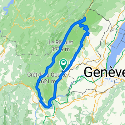 tour du jura
- Distance
- 96.7 km
- Ascent
- 1,330 m
- Descent
- 1,324 m
- Location
- Saint-Jean-de-Gonville, Auvergne-Rhône-Alpes, France
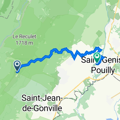 Dole z kopca
- Distance
- 13.4 km
- Ascent
- 36 m
- Descent
- 1,188 m
- Location
- Saint-Jean-de-Gonville, Auvergne-Rhône-Alpes, France
 boucle la pesse
- Distance
- 27.7 km
- Ascent
- 381 m
- Descent
- 382 m
- Location
- Saint-Jean-de-Gonville, Auvergne-Rhône-Alpes, France
 la pesse
- Distance
- 16.3 km
- Ascent
- 200 m
- Descent
- 177 m
- Location
- Saint-Jean-de-Gonville, Auvergne-Rhône-Alpes, France
 Combe de Laisa
- Distance
- 52.7 km
- Ascent
- 1,340 m
- Descent
- 1,341 m
- Location
- Saint-Jean-de-Gonville, Auvergne-Rhône-Alpes, France
 Jura Recon Short
- Distance
- 24.7 km
- Ascent
- 570 m
- Descent
- 567 m
- Location
- Saint-Jean-de-Gonville, Auvergne-Rhône-Alpes, France
 263 Rue du Bourg, Saint-Jean de Gonville to 48 Lotissement Le Clos Saint-Jean, Saint-Jean de Gonville
- Distance
- 38.4 km
- Ascent
- 463 m
- Descent
- 465 m
- Location
- Saint-Jean-de-Gonville, Auvergne-Rhône-Alpes, France
 peron
peron- Distance
- 24.9 km
- Ascent
- 316 m
- Descent
- 254 m
- Location
- Saint-Jean-de-Gonville, Auvergne-Rhône-Alpes, France
Open it in the app