
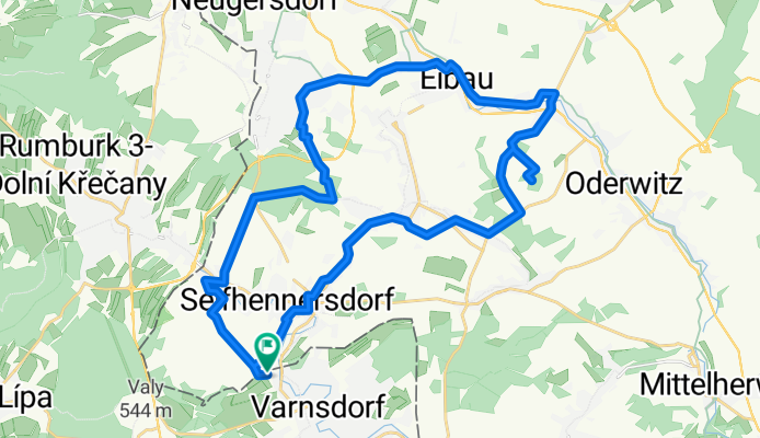
Varnsdorf - Leutersdorf- Spitzberg - Oderwitz Eibau Neugersdorf - Karasekschenke - Varnsdorf
A cycling route starting in Seifhennersdorf, Saxony, Germany.
Overview
About this route
- -:--
- Duration
- 32.9 km
- Distance
- ---
- Ascent
- ---
- Descent
- ---
- Avg. speed
- ---
- Avg. speed
Route quality
Waytypes & surfaces along the route
Waytypes
Quiet road
14.4 km
(44 %)
Track
7.4 km
(22 %)
Surfaces
Paved
21.6 km
(66 %)
Unpaved
1.8 km
(6 %)
Asphalt
15.8 km
(48 %)
Concrete
5.8 km
(18 %)
Continue with Bikemap
Use, edit, or download this cycling route
You would like to ride Varnsdorf - Leutersdorf- Spitzberg - Oderwitz Eibau Neugersdorf - Karasekschenke - Varnsdorf or customize it for your own trip? Here is what you can do with this Bikemap route:
Free features
- Save this route as favorite or in collections
- Copy & plan your own version of this route
- Sync your route with Garmin or Wahoo
Premium features
Free trial for 3 days, or one-time payment. More about Bikemap Premium.
- Navigate this route on iOS & Android
- Export a GPX / KML file of this route
- Create your custom printout (try it for free)
- Download this route for offline navigation
Discover more Premium features.
Get Bikemap PremiumFrom our community
Other popular routes starting in Seifhennersdorf
 002 Kleine Mandautalroute
- Distance
- 26.8 km
- Ascent
- 106 m
- Descent
- 104 m
- Location
- Seifhennersdorf, Saxony, Germany
 Seifh,-Jeschken
- Distance
- 53.2 km
- Ascent
- 978 m
- Descent
- 343 m
- Location
- Seifhennersdorf, Saxony, Germany
 Seifh.-Weifberg
- Distance
- 53.2 km
- Ascent
- 681 m
- Descent
- 681 m
- Location
- Seifhennersdorf, Saxony, Germany
 20160522_160255.gpx
- Distance
- 20.9 km
- Ascent
- 131 m
- Descent
- 142 m
- Location
- Seifhennersdorf, Saxony, Germany
 Kirnitzsch Tour
- Distance
- 53.2 km
- Ascent
- 419 m
- Descent
- 654 m
- Location
- Seifhennersdorf, Saxony, Germany
 Seifh.-Wolfsberg
- Distance
- 29.9 km
- Ascent
- 279 m
- Descent
- 278 m
- Location
- Seifhennersdorf, Saxony, Germany
 Training 16 km
- Distance
- 16 km
- Ascent
- 179 m
- Descent
- 179 m
- Location
- Seifhennersdorf, Saxony, Germany
 Seifh.-Hochwald
- Distance
- 43.6 km
- Ascent
- 603 m
- Descent
- 605 m
- Location
- Seifhennersdorf, Saxony, Germany
Open it in the app