

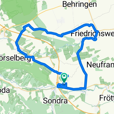
TH-Hörselberge-Sättelstädt-Wutha
A cycling route starting in Mechterstädt, Free State of Thuringia, Germany.
Overview
About this route
Route für Anja
- -:--
- Duration
- 9.1 km
- Distance
- 313 m
- Ascent
- 338 m
- Descent
- ---
- Avg. speed
- 472 m
- Avg. speed

Route quality
Waytypes & surfaces along the route
Waytypes
Path
7.9 km
(86 %)
Track
0.6 km
(7 %)
Surfaces
Paved
0.5 km
(6 %)
Unpaved
8.2 km
(90 %)
Ground
7.4 km
(81 %)
Gravel
0.9 km
(9 %)
Continue with Bikemap
Use, edit, or download this cycling route
You would like to ride TH-Hörselberge-Sättelstädt-Wutha or customize it for your own trip? Here is what you can do with this Bikemap route:
Free features
- Save this route as favorite or in collections
- Copy & plan your own version of this route
- Sync your route with Garmin or Wahoo
Premium features
Free trial for 3 days, or one-time payment. More about Bikemap Premium.
- Navigate this route on iOS & Android
- Export a GPX / KML file of this route
- Create your custom printout (try it for free)
- Download this route for offline navigation
Discover more Premium features.
Get Bikemap PremiumFrom our community
Other popular routes starting in Mechterstädt
 Am Noßbach 1, Hörselberg-Hainich nach Am Noßbach 1, Hörselberg-Hainich
- Distance
- 31.7 km
- Ascent
- 724 m
- Descent
- 726 m
- Location
- Mechterstädt, Free State of Thuringia, Germany
 TH-Hörselberge-Sättelstädt-Wutha
- Distance
- 9.1 km
- Ascent
- 313 m
- Descent
- 338 m
- Location
- Mechterstädt, Free State of Thuringia, Germany
 ¿œ∆⁄? nach ¿œ∆⁄?
- Distance
- 23.5 km
- Ascent
- 428 m
- Descent
- 396 m
- Location
- Mechterstädt, Free State of Thuringia, Germany
 Am Noßbach 1, Hörselberg-Hainich nach Am Noßbach 1, Hörselberg-Hainich
- Distance
- 31.8 km
- Ascent
- 349 m
- Descent
- 349 m
- Location
- Mechterstädt, Free State of Thuringia, Germany
 Am Fridolinsdamm 6, Hörsel nach Karolinenstraße, Eisenach
- Distance
- 22 km
- Ascent
- 188 m
- Descent
- 267 m
- Location
- Mechterstädt, Free State of Thuringia, Germany
 Westliche Thüringer Wald Tour
- Distance
- 79 km
- Ascent
- 784 m
- Descent
- 784 m
- Location
- Mechterstädt, Free State of Thuringia, Germany
 sättelst_hain
- Distance
- 21.3 km
- Ascent
- 136 m
- Descent
- 186 m
- Location
- Mechterstädt, Free State of Thuringia, Germany
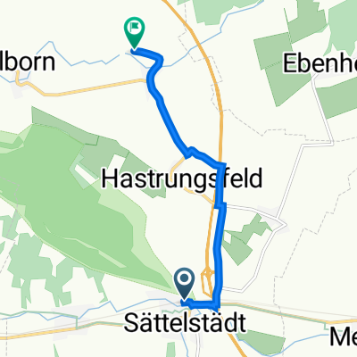 Sättelstädt - Klappmühle
- Distance
- 4.9 km
- Ascent
- 30 m
- Descent
- 53 m
- Location
- Mechterstädt, Free State of Thuringia, Germany
Open it in the app