

Moosbach-Silbersbach (Bayer. Wald)
A cycling route starting in Moosbach, Bavaria, Germany.
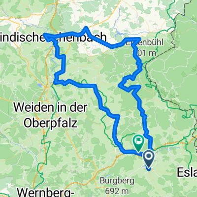
Overview
About this route
Diese Streckenführung kann als Teil einer "Oberpfalz-Bayerwald-Tour" verwendet werden. Wir sind die Strecke schon einige male gefahren. Sie ist recht verkehrsarm und deshalb gut zu radeln. Die Gesamtstrecke ist mittelmäßig anspruchsvoll - zwischen Waldmünchen und Furth im Wald liegt der Gelißenberg als etwas anspruchsvolle Steigung und dann ist vor allem zwischen Neukirchen Hl.Blut und Lam eine sehr anspruchsvolle Steigung zu überwinden. In der Fortführung der Route steigt der Anspruch an den trainierten Radler mit dem Arber und anderen Mittelgebirgsspitzen.
- -:--
- Duration
- 84 km
- Distance
- 1,360 m
- Ascent
- 1,302 m
- Descent
- ---
- Avg. speed
- 812 m
- Avg. speed

Route quality
Waytypes & surfaces along the route
Waytypes
Busy road
45.1 km
(54 %)
Road
19.6 km
(23 %)
Surfaces
Paved
54.1 km
(64 %)
Unpaved
3.6 km
(4 %)
Asphalt
53.2 km
(63 %)
Ground
1.8 km
(2 %)
Continue with Bikemap
Use, edit, or download this cycling route
You would like to ride Moosbach-Silbersbach (Bayer. Wald) or customize it for your own trip? Here is what you can do with this Bikemap route:
Free features
- Save this route as favorite or in collections
- Copy & plan your own version of this route
- Sync your route with Garmin or Wahoo
Premium features
Free trial for 3 days, or one-time payment. More about Bikemap Premium.
- Navigate this route on iOS & Android
- Export a GPX / KML file of this route
- Create your custom printout (try it for free)
- Download this route for offline navigation
Discover more Premium features.
Get Bikemap PremiumFrom our community
Other popular routes starting in Moosbach
 Moosbach - Pleysten - Vohenstrauß - Moosbach
- Distance
- 34.5 km
- Ascent
- 455 m
- Descent
- 451 m
- Location
- Moosbach, Bavaria, Germany
 Pentalonclubs-Wadelbeisserrunde
- Distance
- 100.2 km
- Ascent
- 1,485 m
- Descent
- 1,442 m
- Location
- Moosbach, Bavaria, Germany
 pohodová ceta
- Distance
- 106.2 km
- Ascent
- 1,152 m
- Descent
- 1,129 m
- Location
- Moosbach, Bavaria, Germany
 21 Oberpfalzweg
- Distance
- 83.8 km
- Ascent
- 1,056 m
- Descent
- 1,196 m
- Location
- Moosbach, Bavaria, Germany
 Moosbach-Fahrenberg-Georgenberg-Primda
- Distance
- 81.2 km
- Ascent
- 1,314 m
- Descent
- 1,275 m
- Location
- Moosbach, Bavaria, Germany
 Pentalon Hausstrecke-Feierabendroute
- Distance
- 46.8 km
- Ascent
- 651 m
- Descent
- 598 m
- Location
- Moosbach, Bavaria, Germany
 Pentalon_Hausrunde
- Distance
- 47.1 km
- Ascent
- 681 m
- Descent
- 620 m
- Location
- Moosbach, Bavaria, Germany
 Moosbach-Silbersbach (bayer. Wald)
- Distance
- 88.3 km
- Ascent
- 1,152 m
- Descent
- 1,123 m
- Location
- Moosbach, Bavaria, Germany
Open it in the app