
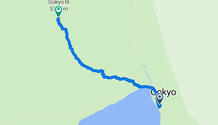
GokyoRi
A cycling route starting in Lobujya, Eastern Region, Nepal.
Overview
About this route
- -:--
- Duration
- 1.9 km
- Distance
- 584 m
- Ascent
- 9 m
- Descent
- ---
- Avg. speed
- ---
- Avg. speed
Continue with Bikemap
Use, edit, or download this cycling route
You would like to ride GokyoRi or customize it for your own trip? Here is what you can do with this Bikemap route:
Free features
- Save this route as favorite or in collections
- Copy & plan your own version of this route
- Sync your route with Garmin or Wahoo
Premium features
Free trial for 3 days, or one-time payment. More about Bikemap Premium.
- Navigate this route on iOS & Android
- Export a GPX / KML file of this route
- Create your custom printout (try it for free)
- Download this route for offline navigation
Discover more Premium features.
Get Bikemap PremiumFrom our community
Other popular routes starting in Lobujya
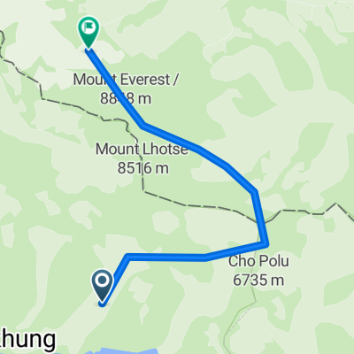
 Subida al Everest
- Distance
- 22.5 km
- Ascent
- 7,914 m
- Descent
- 4,419 m
- Location
- Lobujya, Eastern Region, Nepal
 Etapa 8 - Chukhung ( 4.730 m ) - Kongma La Pass ( 5.535 m ) - Lobuche ( 4.940 m ) - Trekking 3 pasos Everest
- Distance
- 10.7 km
- Ascent
- 931 m
- Descent
- 758 m
- Location
- Lobujya, Eastern Region, Nepal
 bb
bb- Distance
- 19.8 km
- Ascent
- 5,581 m
- Descent
- 4,408 m
- Location
- Lobujya, Eastern Region, Nepal
 Island Peak BC - Chukung
- Distance
- 14.3 km
- Ascent
- 449 m
- Descent
- 444 m
- Location
- Lobujya, Eastern Region, Nepal
 Gorakshep-Dingboche
- Distance
- 15.7 km
- Ascent
- 504 m
- Descent
- 1,314 m
- Location
- Lobujya, Eastern Region, Nepal
 Fun Everest
- Distance
- 17 km
- Ascent
- 4,165 m
- Descent
- 581 m
- Location
- Lobujya, Eastern Region, Nepal
 Chukung - Island Peak BC and back
- Distance
- 31.2 km
- Ascent
- 807 m
- Descent
- 807 m
- Location
- Lobujya, Eastern Region, Nepal
 Kongma la to Chukung
- Distance
- 11 km
- Ascent
- 649 m
- Descent
- 833 m
- Location
- Lobujya, Eastern Region, Nepal
Open it in the app