

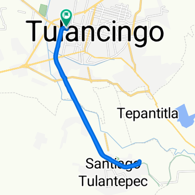
Calle Rodolfo Guzmán Huerta Santo el Enmascarado de Plata 108, Tulancingo to Calle Rodolfo Guzmán Huerta Santo el Enmascarado de Plata 13, Tulancingo
A cycling route starting in Tulancingo, Hidalgo, Mexico.
Overview
About this route
- 1 h 13 min
- Duration
- 14.2 km
- Distance
- 292 m
- Ascent
- 296 m
- Descent
- 11.7 km/h
- Avg. speed
- 2,203 m
- Avg. speed
Route quality
Waytypes & surfaces along the route
Waytypes
Cycleway
12.7 km
(89 %)
Quiet road
0.7 km
(5 %)
Surfaces
Paved
5.1 km
(36 %)
Asphalt
4.8 km
(34 %)
Concrete
0.3 km
(2 %)
Undefined
9.2 km
(64 %)
Continue with Bikemap
Use, edit, or download this cycling route
You would like to ride Calle Rodolfo Guzmán Huerta Santo el Enmascarado de Plata 108, Tulancingo to Calle Rodolfo Guzmán Huerta Santo el Enmascarado de Plata 13, Tulancingo or customize it for your own trip? Here is what you can do with this Bikemap route:
Free features
- Save this route as favorite or in collections
- Copy & plan your own version of this route
- Sync your route with Garmin or Wahoo
Premium features
Free trial for 3 days, or one-time payment. More about Bikemap Premium.
- Navigate this route on iOS & Android
- Export a GPX / KML file of this route
- Create your custom printout (try it for free)
- Download this route for offline navigation
Discover more Premium features.
Get Bikemap PremiumFrom our community
Other popular routes starting in Tulancingo
 De Francisco Mendoza 606, Tulancingo de Bravo a Ignacio Zaragoza 319, Tulancingo de Bravo
- Distance
- 23.9 km
- Ascent
- 139 m
- Descent
- 84 m
- Location
- Tulancingo, Hidalgo, Mexico
 Calle 2, Tulancingo a Retorno Monte Albán 2, Tulancingo
- Distance
- 6 km
- Ascent
- 9 m
- Descent
- 23 m
- Location
- Tulancingo, Hidalgo, Mexico
 Ciclopista del Ferrocarril, Tulancingo a Calle 5 de Mayo 34, Jaltepec
- Distance
- 8.5 km
- Ascent
- 35 m
- Descent
- 37 m
- Location
- Tulancingo, Hidalgo, Mexico
 De Libramiento la Joya, Tulancingo a Calle Chamizal 15, Tulancingo
- Distance
- 41.6 km
- Ascent
- 1,197 m
- Descent
- 1,149 m
- Location
- Tulancingo, Hidalgo, Mexico
 De Calle Rio Panuco 18–20, Tulancingo a Calle Rio Panuco 18–20, Tulancingo
- Distance
- 13.2 km
- Ascent
- 46 m
- Descent
- 47 m
- Location
- Tulancingo, Hidalgo, Mexico
 De Calle Cristóbal Colon 40, Tulancingo a Avenida Pleasenton, Tulancingo
- Distance
- 13.9 km
- Ascent
- 6 m
- Descent
- 13 m
- Location
- Tulancingo, Hidalgo, Mexico
 De Calle Cristóbal Colon 20, Tulancingo a Calle Cristóbal Colon 22, Tulancingo
- Distance
- 13.9 km
- Ascent
- 25 m
- Descent
- 22 m
- Location
- Tulancingo, Hidalgo, Mexico
 Los Alamos, Tulancingo to Calle Rodolfo Guzmán Huerta Santo el Enmascarado de Plata 13, Tulancingo
- Distance
- 16.8 km
- Ascent
- 86 m
- Descent
- 86 m
- Location
- Tulancingo, Hidalgo, Mexico
Open it in the app